 Sailing Painkiller
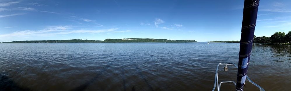
St Clair River and Lake St Clair
We left Lexington about 6 am. We have about 57 miles to go today. Our destination is North Star Sailing Club which is located up the Clinton River on Lake St Clair.
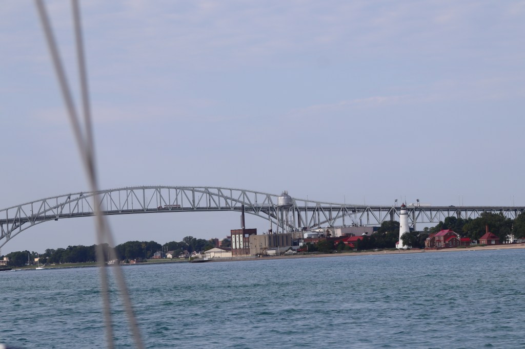
Today we will have a variety of geography. A couple of hours on southern Lake Huron before we enter the mouth of the St Clair River. The picture above is the Blue Water Bridge that marks the entrance to the St Clair River. The St Clair River is about 40 miles long and only 1/2 mile wide. Keep in mind that commercial freighter traffic and tankers come through this river as well and we need to share the 1/2 miles wide space with up to 1,000 foot freighters! The St Clair River also drops in elevation by 5 feet from Lake Huron to Lake St Clair. It is because of this drop in elevation there is up to a 2 knot current in the river.
Once we get through the river then we enter Lake St Clair. The St Clair River branches into several channels creating a broad delta region known as St Clair Flats. Words like broad delta and flats translate into shallow water. We really have to watch our depth in here.
So, today brings a variety of challenges that we haven’t yet encountered. Rivers, currents, shallow water, tight quarters with big ships. Should be an interesting day.
Once we left Lexington, we have large rolling seas for a couple of hours while we headed toward the river. Lake Huron was still churned up from the recent storms.
As we approached the Blue Water Bridge, there was a bunch of freighter traffic coming our way and we were trying to time to see which would be in front of us and who might be at the bridge the same time we were. We don’t want to enter the river and go under the bridge at the same time as a freighter. Never play chicken with a freighter!
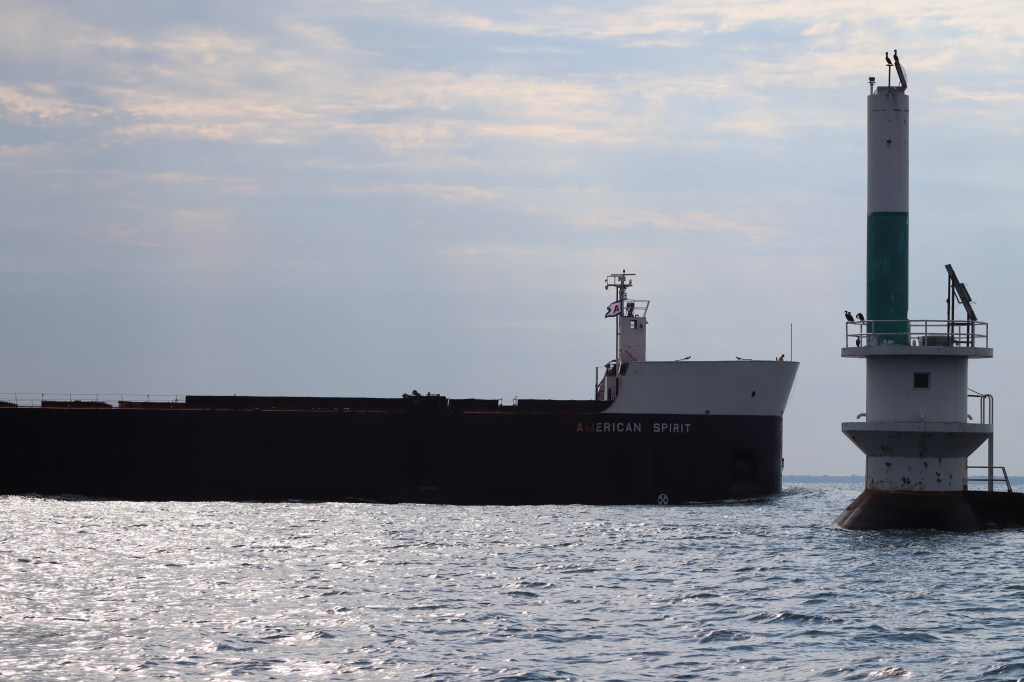
A couple freighters pass in front of us. One in particular, American Spirit, it seems we are destined to encounter him at the bridge. So, we decided to make some decisive moves to turned around to head away from the bridge to let him know that he is free to go ahead and we will fall in behind him.
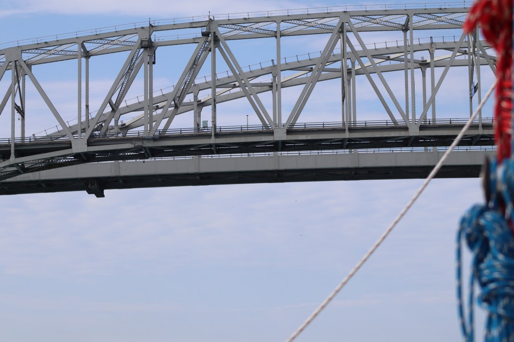
Passing under the Blue Water Bridge. It doesn’t matter how tall a bridge is, it always looks like you are going to hit it. This particular bridge has a clearance of 135 ft. We only need about 57 feet to clear, so we are good.
The St Clair River is also the dividing line between the US and Canada. The US is on the right hand side of the boat and Canada is on our left.

As we were passing under the bridge, the current became evident and pushed our boat around slightly. It increased our boat speed about 1.5 knots. The roughest area was right near the bridge and as we made our way further down the river it was just a gentle current we were riding down river.
We encountered several sailboats motoring up the St Clair River toward the Port Huron Yacht Club. They were all racing boats that are likely headed from Detroit up the river to participate in the Port Huron to Mackinac race that starts tomorrow. Port Huron Yacht Club looks all ready for the race festivities.

The rest of our journey on the St Clair River was quite pleasant and departure from our open water lake sailing. It was nice to see houses and scenery going by to keep the ride interesting and the time went by quickly. Lots of nice houses along the river.

We did encounter a couple of freighters on the narrow river. Here is one that passed by us. That is close enough!

Then we came to the bottom of the river where it divides into multiple channels in the delta region. We had to pick which channel we would use. This was decided for us based on our final destination of the Clinton River, we would head down the northern most channel depicted below. We had questioned multiple people we met before now about navigating this channel and it depths. All the advice we got was the same – stay in the channel! Lots of bouys mark the channel along the way. Red and green, go between! Here’s what the area looks like on the chart.
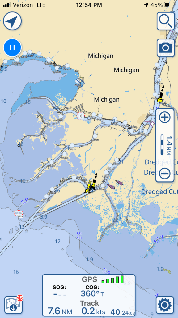
As we were heading through the northern most channel all was well until we got to the lower part of the channel that enters Lake St Clair, this is where is get the most shallow. The channel markers are now barely as wide as our boat and should we encounter another boat coming through this narrow channel, they better draft less than us, cuz we aren’t moving out of the channel. Our boat drafts 4 foot 6 inches. There were areas where we saw as little as 5 – 6 feet of water and if we moved literally a foot or two in the wrong direction we could be in 2 feet of water. It took both Mark and I to be fully attentive with both the chart plotter and ipad going to pick our way through this narrow skinny water. But success! We were now in relatively deeper water at 10 feet in Lake St Clair.
We made our way across Lake St Clair and about a mile up the Clinton River to dock at the North Star Sailing Club. We plan to be here for a couple of days!

So enjoying your journey!
Sent from my iPhone Carole Bloom
>
LikeLike