 Sailing Painkiller
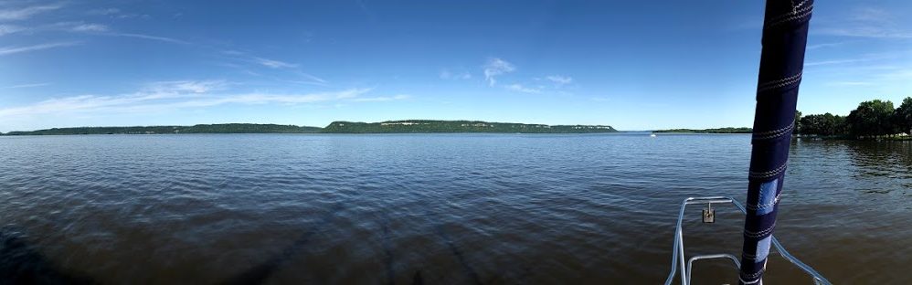

Since we are in Charlevoix for 3 nights, we have time to relax, not feel rushed to visit the town and can generally kick back. However, kicking back on a boat doesn’t necessarily have the fruity drink with an umbrella in hand that you might be thinking about. A day off from sailing and exploring means we have time to do boat projects.
Now, if you remember back to our time in Leland, Michigan, we got a fair amount of rain while we were there. We also just put our mast back on the boat this spring when we launched it in Manitowoc. We discovered with the rain that we did a less than stellar job of sealing around the mast when it was put back into the boat. We had lots of water leaking around our mast during the rain storms and we had the time now to address those leaks and get everything sealed up the way it should be.
Our mast is a keel stepped mast. What does that mean you say? It means the mast goes all the way through the cabin top, through the main cabin of the boat and through the floor in the main cabin and rests on the keel of the boat. The other variation, is a deck stepped mast where the mast sits on the top of the deck and doesn’t go through the cabin. So, with the seal around the mast at the deck level not being water tight, the water was dripping down the mast through the cabin and onto the our carpeted main cabin floor.
So, first we took apart the protection around the base of the mast.
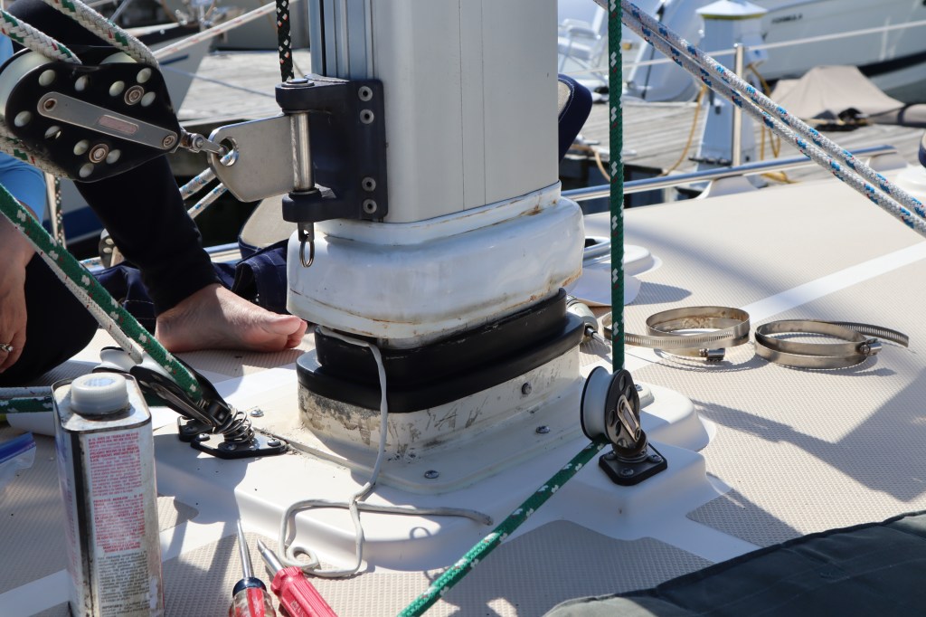
That white part covers everything and gets screwed down tight with a large hose clamp and that black rubber part is supposed to get squeezed by the hose clamps to make a tight seal around the mast. When we took the large hose clamps off, #1 the hose clamps seemed too loose and perhaps we didn’t tighten them enough. #2 the black rubber thing was not tight enough to the mast and we could see daylight when looking up from down below.

To ensure a tight seal, we took some butyl tape (this stuff is amazing for lots of things) and fashioned a very thin long snake out of it. Tape seems to be a funny word for this since it’s really the consistency of modeling clay or silly putty and doesn’t really stick to anything but is great for making a water tight seal and is easy to work with and easy to remove should you need to. We put the really long thin snake on the top of the black rubber thing to create a seal at the top so rain could not enter.

We then wrapped the black rubber with a product call mast boot tape. It’s a white tape that sticks to itself but is not adhesive really and it’s very stretchy to stretch it around the whole mast to add to our water tightness. Then we slid the white cover part back down over this and tightened the hose clamps nice and tight to ensure it was clamping everything as it should.
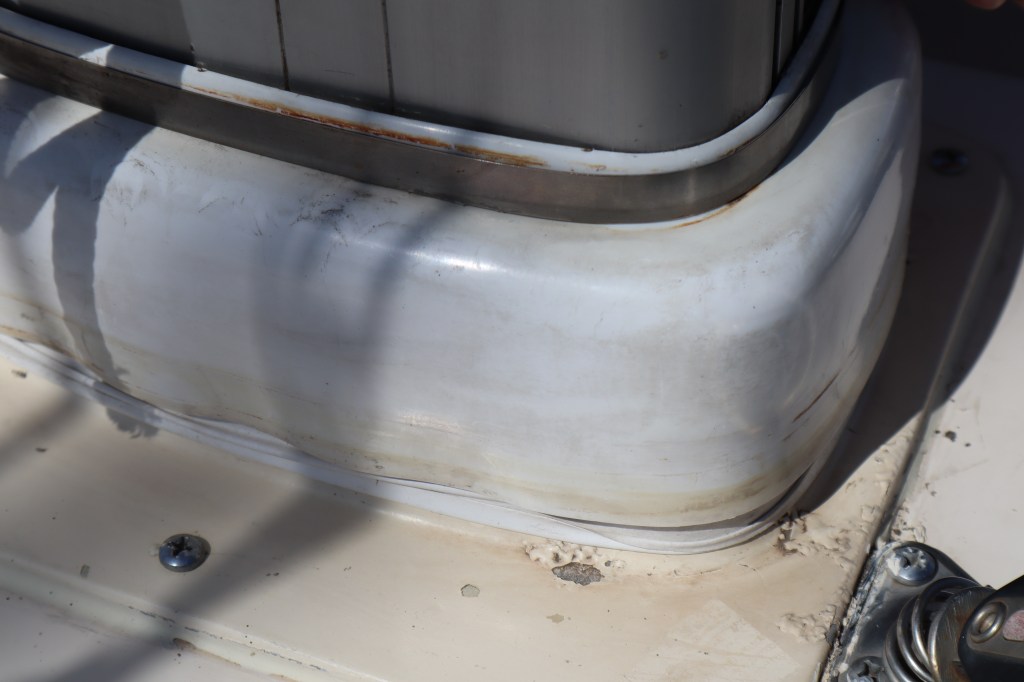
See that gap between the mast and the top of the white cover? Keep tightening so there is no gap for rain to find it’s way into the cabin. Then as a final step we applied another wrap of the mast boot tape around the whole thing. Then it gets covered with a canvas mast boot that I sewed to put around the bottom of the mast a few years ago. Done! Hopefully then next time it rains we will be dry in the cabin.
Next up was to re-install our cockpit table. We removed the cockpit table last summer when we replaced our entire steering pedestal and we haven’t yet gotten around to re-installing the cockpit table. Mostly, we haven’t re-installed it since we were debating how we wanted to mount it and when we have something that is shiny and new on the boat, the last thing you want to do it get out the drill and drill a bunch of holes in it.
Step one – measure, measure and measure.

As you can see, the placement of the brackets are a bit tricky since we are mounting this to a curved surface. Took us quite awhile to find where the center is and the spacing of the brackets and ensuring it’s level, etc. Then we drilled….

We got the top bracket for the table all mounted and then the easy part was the lower bracket since it was on a nice flat surface. Here’s the table in it’s down position and then in the up position. All ready to use!


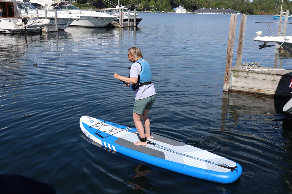
It wasn’t all work today. I found sometime to inflate our new stand-up paddle board and take it for a spin around the harbor.


The next day was more relaxation, however more of the fruity umbrella drink variety. We spent the afternoon having cocktails on the dock with other boats we met who are from Charlevoix and told us all the stories about Charlevoix and their boating adventures. We made another visit to the town brewery and visited the village cafe for a white fish dinner.

Ok, so let’s start off on the right foot, Charlevoix is pronounced Shar – le – voy, the ending rhymes with boy. If you pronounce is Shar – le – voo, you will get funny looks – like – your not from around here are you? Ask us how we know this. After 3 or 4 days I think we finally got it right.
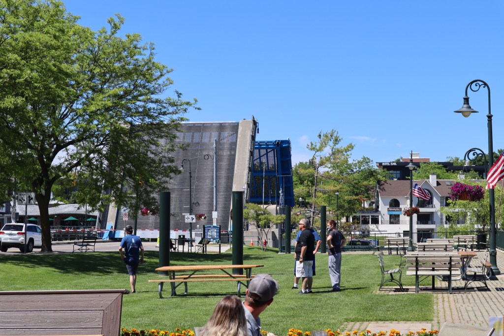
Today is Thursday June 25th and we left Northport after an overnight stay around 8:15 am this morning and we are heading the 21 nm to Charlevoix (remember rhymes with boy) for a 3 night stay. We are looking forward to Charlevoix as we have heard lots of great things about this town and the marina. Reservations were hard to come by and I made sure we called at least a week in advance, as they were full the weekend we were there.
One of our favorite sailing youtube channels is Sailing Soulianis. They are a couple that is originally from the Lake Michigan area and we have watched their journeys on Lake Michigan and in particular their stay in Charlevoix. So, we were excited to get to places that others have been and we have seen through sailing youtube videos.
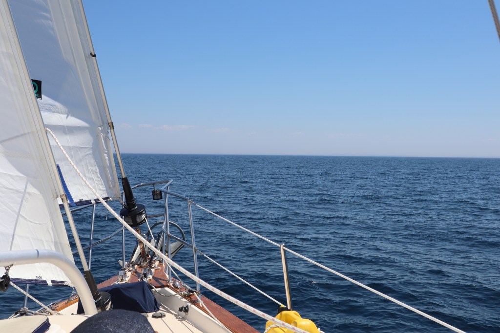
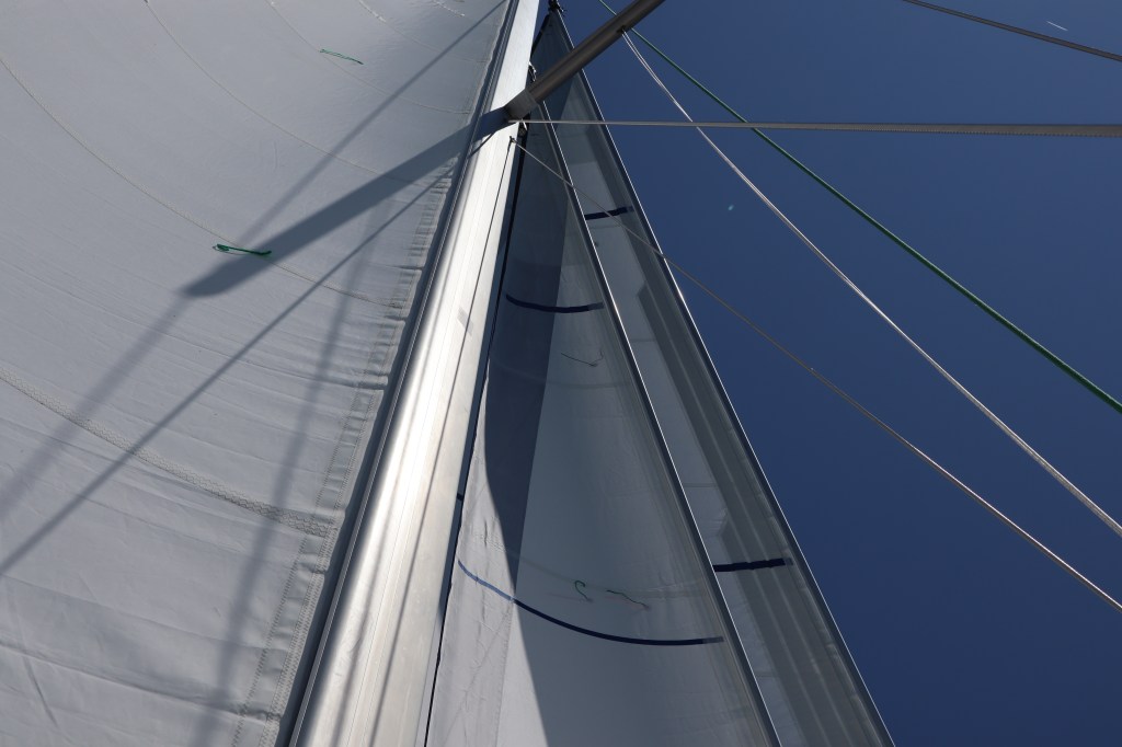
We were having a very pleasant sail this morning:


All of the sudden we see and hear this helicopter and when we look off at the distance toward where is it, we see that it is hovering over a boat on the water in the distance. What is going on over there? Get the binoculars so we can check it out. It appears it’s a coast guard helicopter. Are they actually rescuing someone? We didn’t hear anything, like a mayday, on our VHF. But wait, it appears the boat is a coast guard boat as well. We finally figured out that the coast guard was out here practicing maneuvers and they were actually dropping a couple of guys on wires from the helicopter and landing them on a moving boat. By the time I got out the telephoto lens I think they guys were already on the boat. But we still got some cool photos of the action.


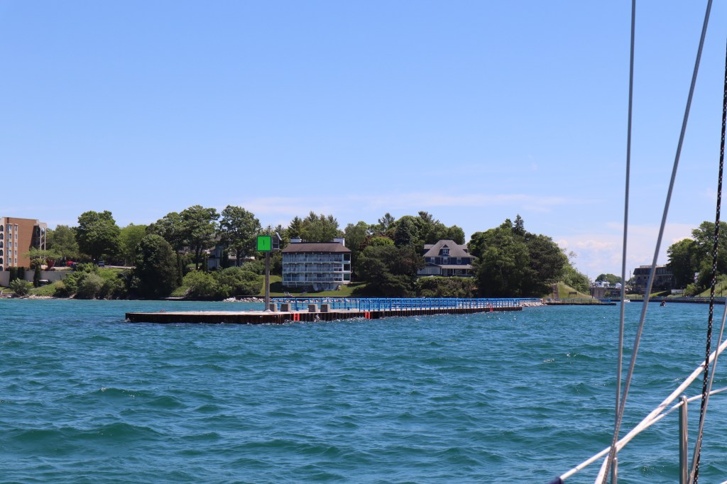
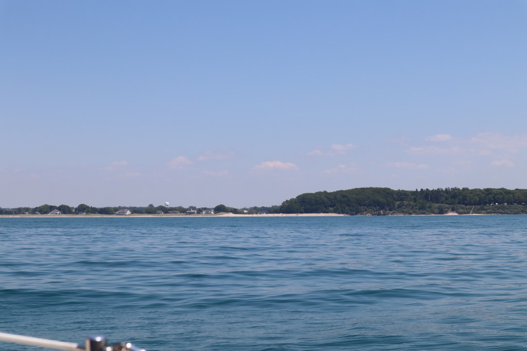
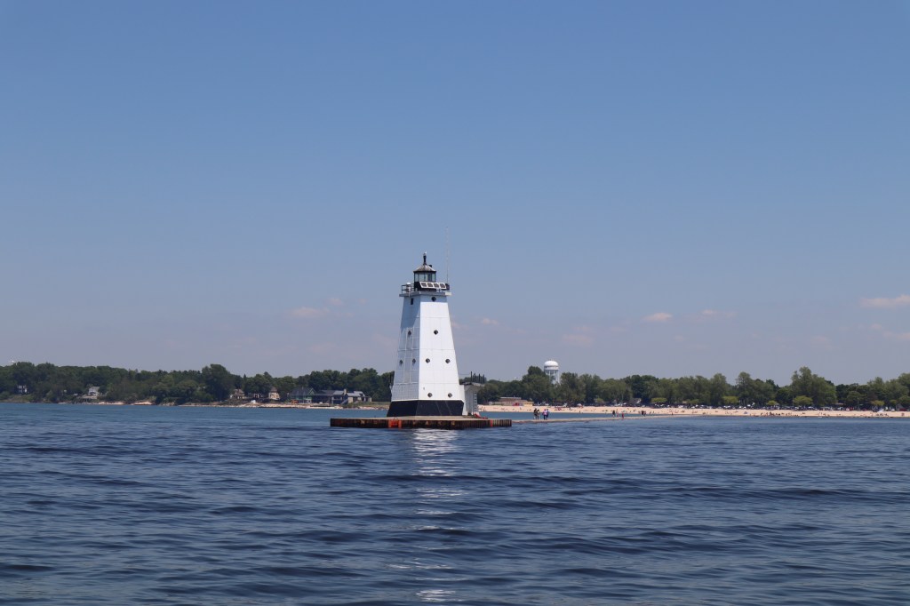
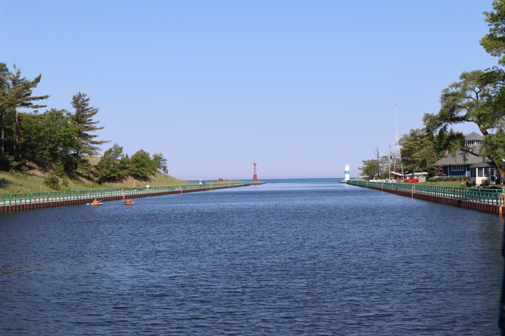
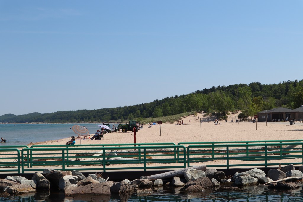
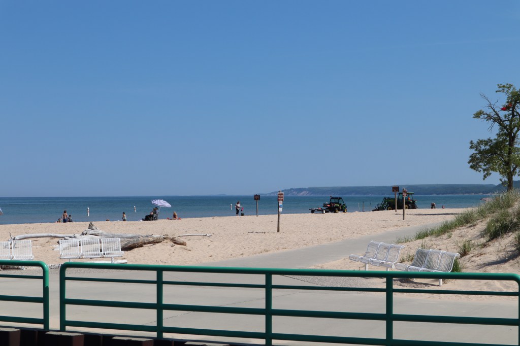
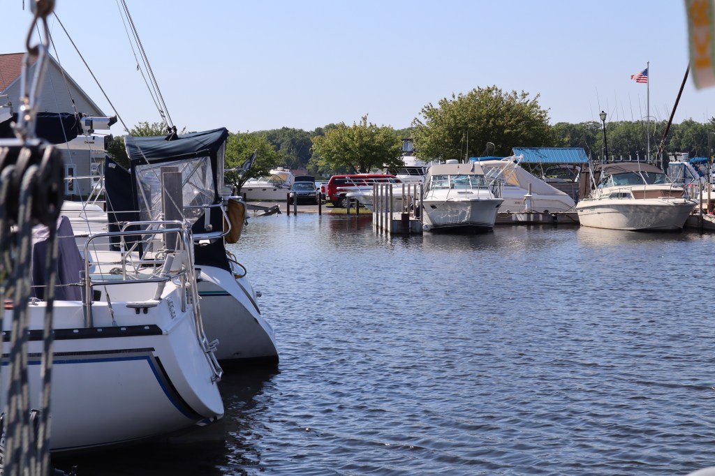
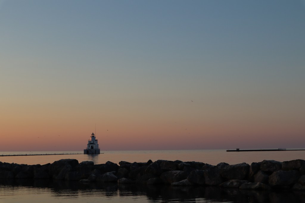
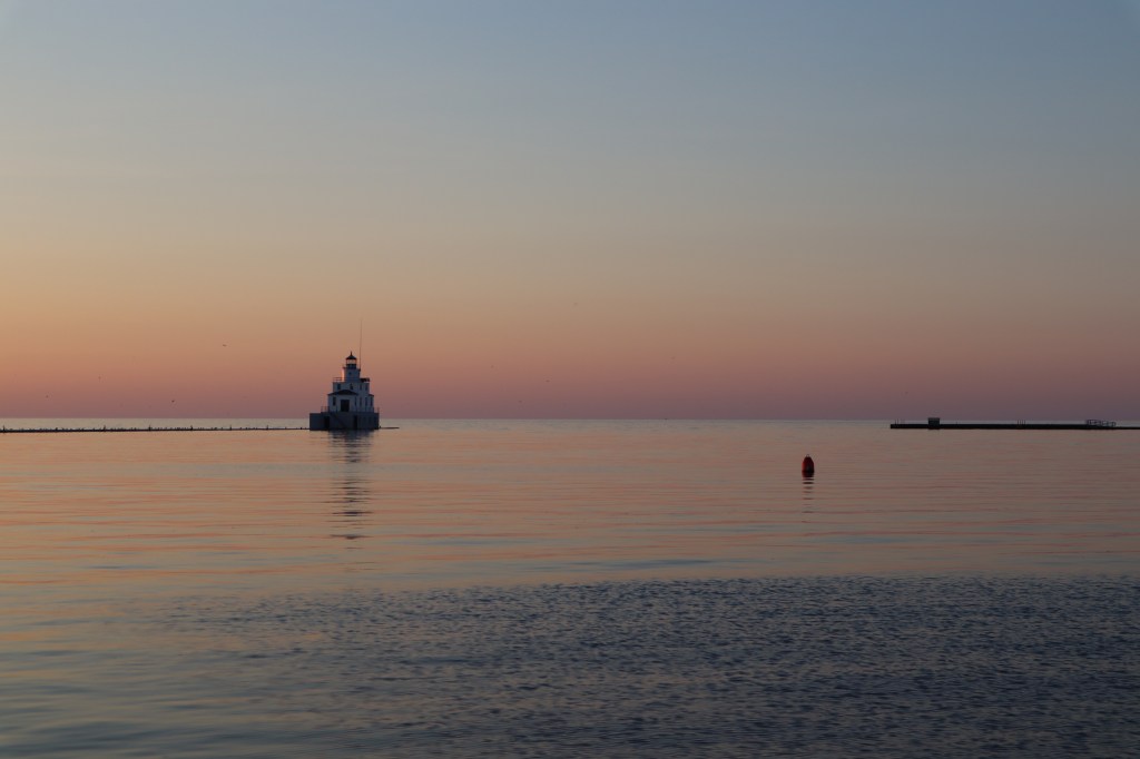
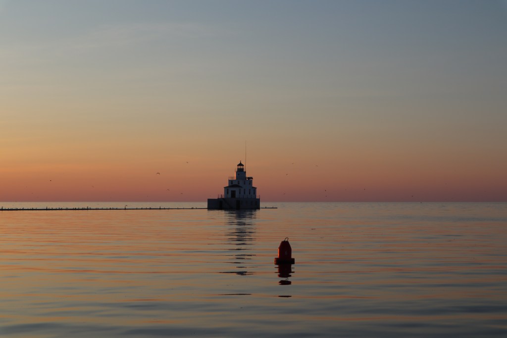
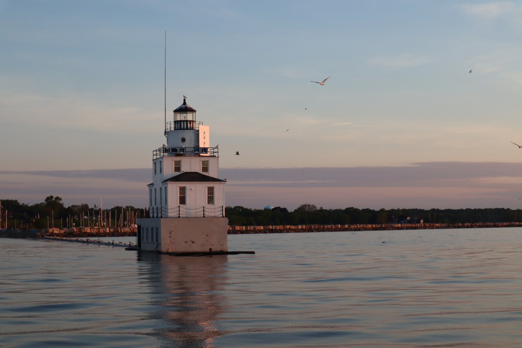
It was beautiful coming into the entrance to Charlevoix. One of the things that makes Charlevoix a great place is once you are inside the entrance the town of Charlevoix sits on what would be otherwise described as a small inland lake – round lake. Then at the end of round lake it opens up a bit more to Lake Charlevoix. All the action with the town and marina are right on round lake the main street of town overlooks the marina.
We wanted to get the dinghy out and go exploring with our dinghy into Lake Charlevoix however, we haven’t put our registration numbers on the dinghy yet and we were warned that the coast guard here was very serious about patrolling these waters and we would likely get a ticket for not having our registration numbers on the dinghy, so we never made it into Lake Charlevoix and stayed in round lake, however we had more then enough to keep us entertained.

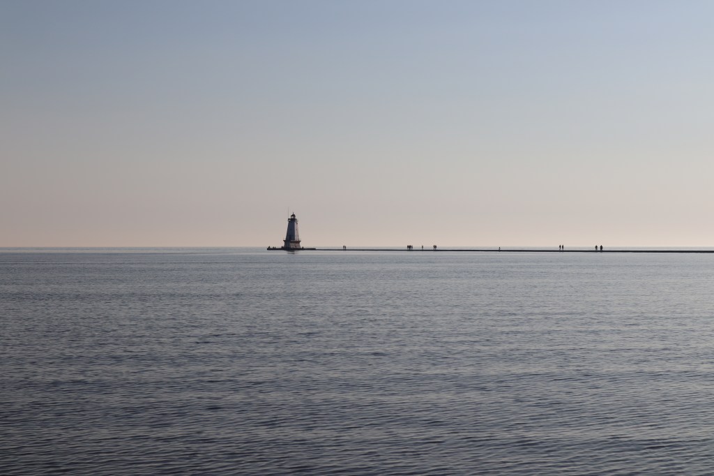
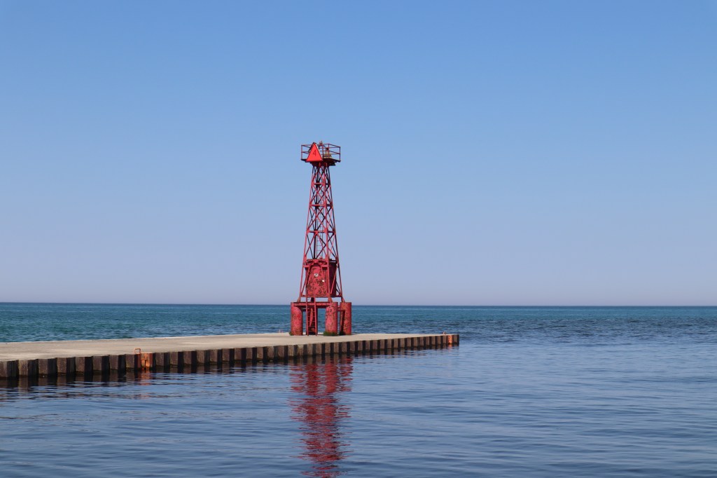
Here’s some photos of the entrance into Charlevoix:
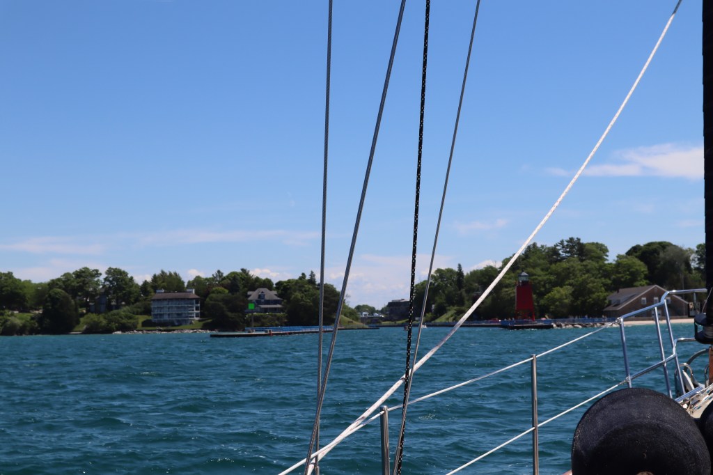
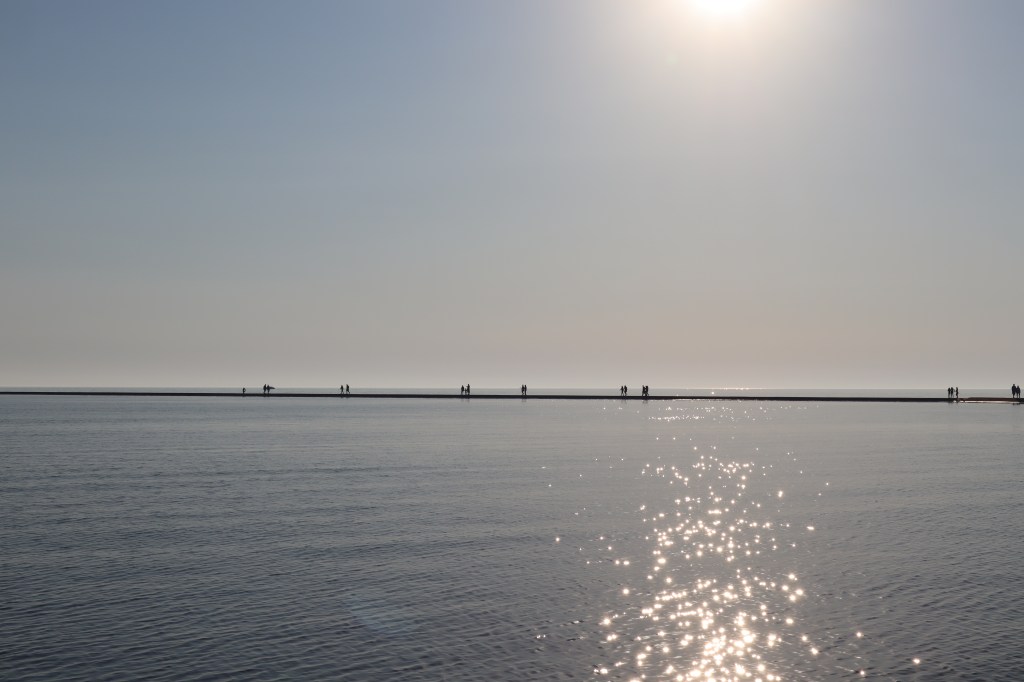
Now, you might notice that there is a bridge at the end of this entrance just before we enter Round Lake. Our mast on the boat is about 56 feet tall and as you can see in the photo above, there is no way a 56 foot mast is getting under that bridge. Thankfully the bridge is a draw bridge that opens every 30 minutes at the top of the hour and the bottom of the hour. Now, this is only the second time we have encountered a bridge on our boat. The first one was in Manitowoc when we had to move from the winter storage building to the marina, that bridge opened on demand, meaning you call them on the VHF and request them to open and they open the bridge for you. This particular bridge however opens on a schedule and does not open on demand. This means we have to carefully time our approach so that we hit, I mean come, to the bridge at the right time. Mark was doing a great job adjusting our boat speed and watching the clock to ensure we didn’t get to the bridge too early. However, there was also a bit of a current that was pushing us toward the bridge.
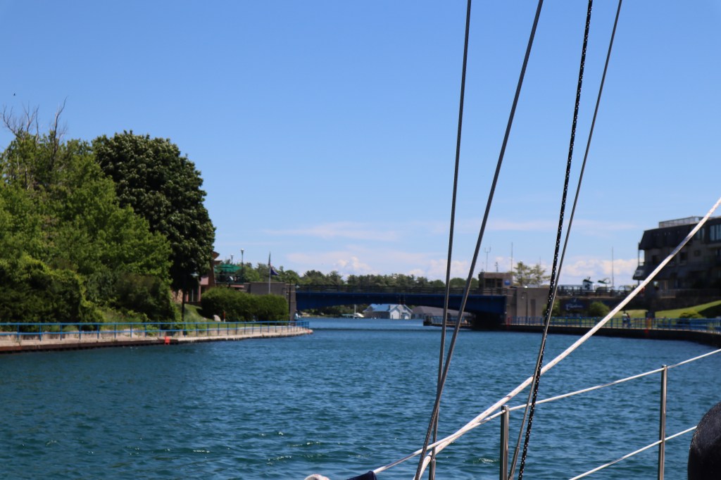
We are starting to get pretty close to the bridge now and we still have a few minutes! And there are people standing all along the area watching as we approach. So, great, we are going to have an audience when we hit this bridge, as at this point, I am certain will be our fate. I am getting really nervous and praying that the bridge tender could open the bridge anytime now. Mark however, is cool as a cucumber. Thank God one of us is. After what seems like an eternity, we hear the sounds of the gates going down to stop traffic from coming across the bridge. It’s going to open!!! Thank God!

Under we go, just like we have done this before! I am now a bundle of nerves and have determined that the reason sailors drink is because of bridges and docks.
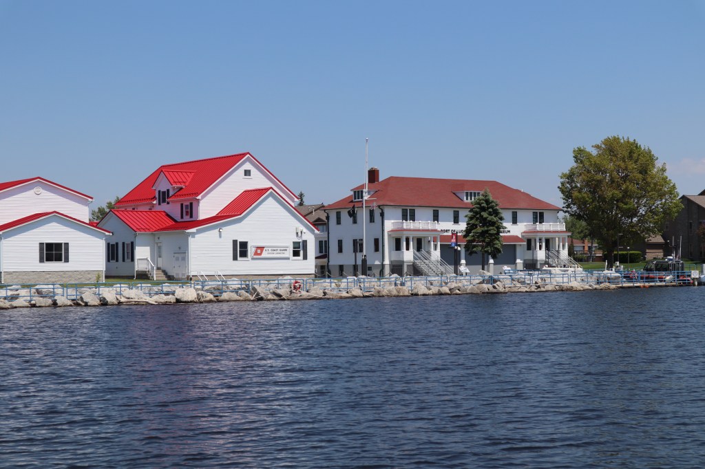
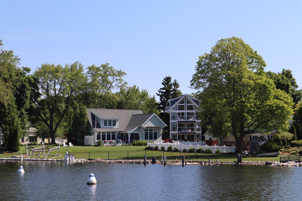
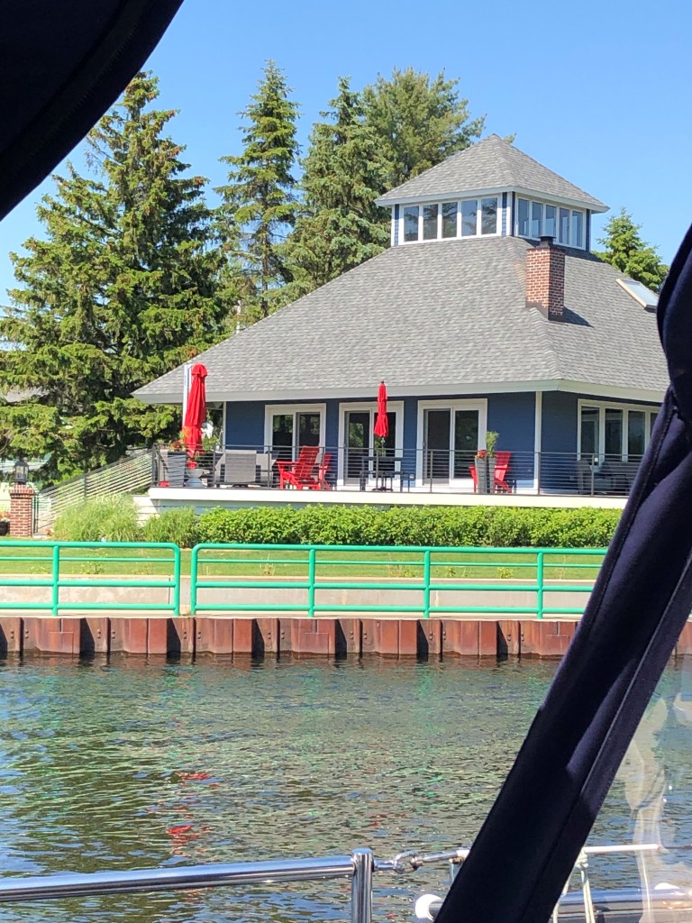
Once we pass through the bridge there was the Emerald Isle ferry that takes people between Charlevoix and Beaver Island. Also there any many beautiful homes that line the shores of Round Lake.

We got settled at the marina – the routine often goes like this: Call marina on VHF as we are getting close to confirm/get slip number. They will often tell us which side to tie so we can get lines ready. So, they might often say starboard tie, bow in, so we know how we will be oriented in the slip. They will usually have marina staff meet us at the dock to help catch lines and guide us in. This is very appreciated! Once we are tied off there is a bit of adjusting the boat and lines in the slip and adding fenders between the boat and the dock before we are satisfied that everything is as it should be. Then we take out our power cords and hook up to the shore power so we can charge our batteries and run the air conditioning. Then we head to the marina office to check in and pay for our slip for the number of nights we are there. Important information to get at the check in is the code or key for the bathrooms and showers, as well as the wi-fi password for the internet. There are often brochures for what is in the area so we can grab those to help check out the area.
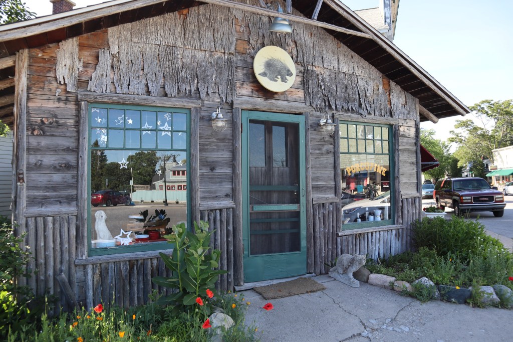
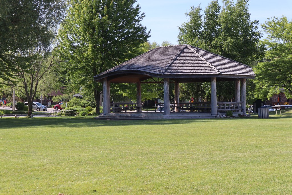
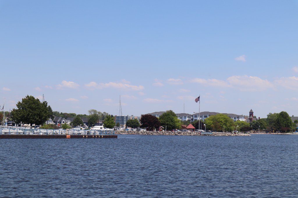
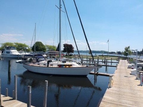
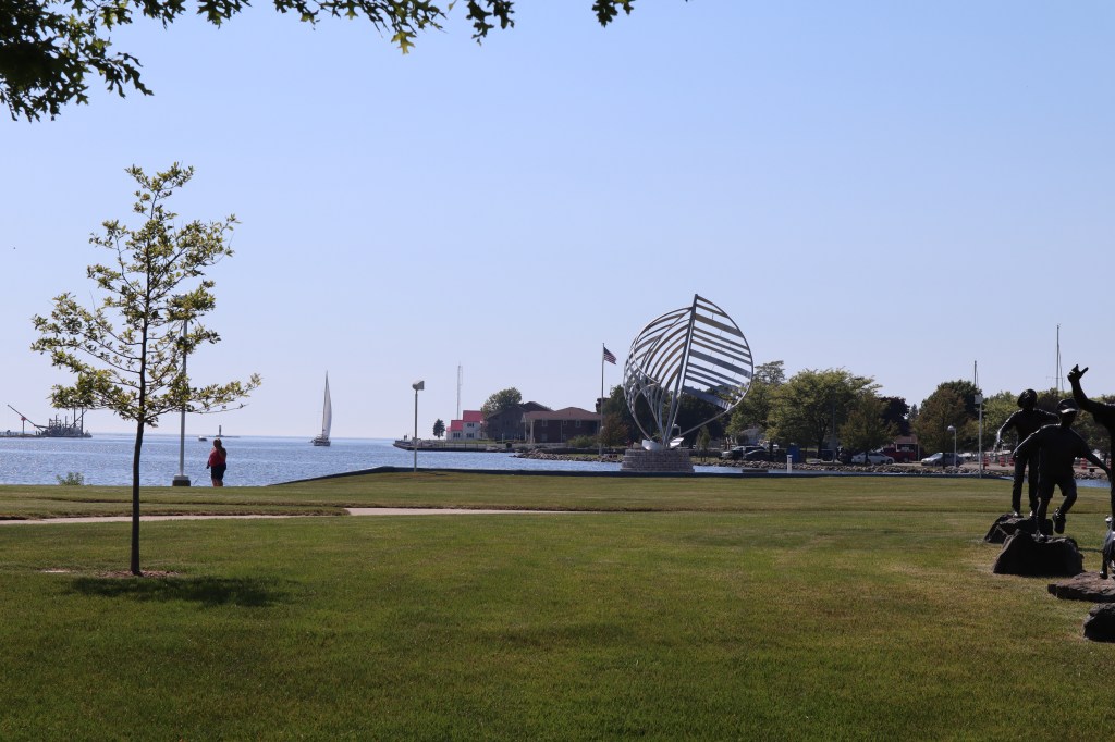
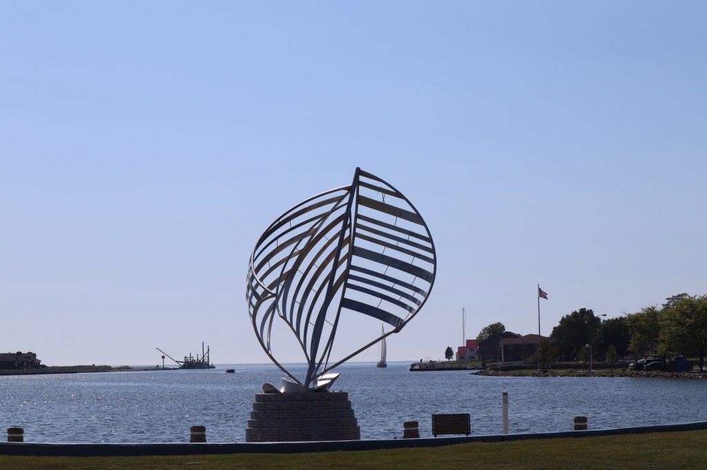
After all is settled, then it’s time to check out our new surroundings. Charlevoix marina has a park that sits right on the edge of the docks and on the other side of the park is the main street. Here are some great photos:


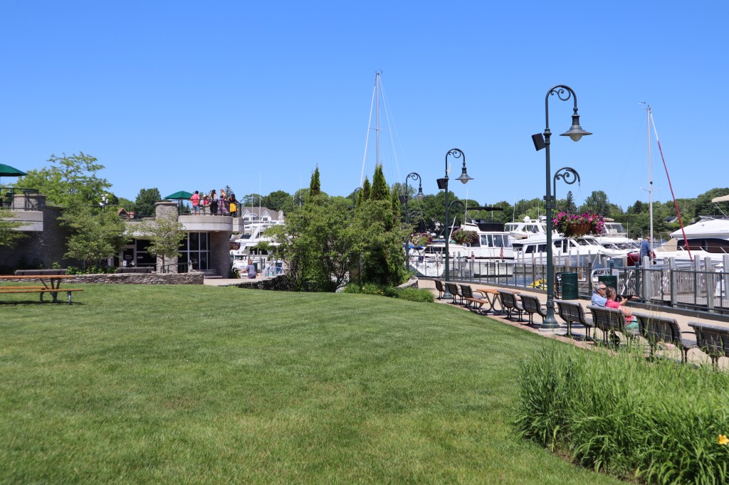

That’s Painkiller with the mast in the center of the photo!
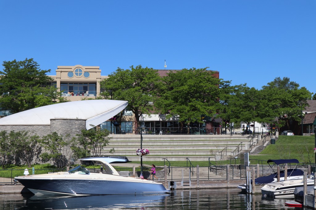
We learned from some local folks on the dock that Charlevoix during non-COVID times has quite the summer celebrations and has historically hosted one of the countries largest fireworks displays for the 4th of July and the band shell pictured above have hosted bands such as Loverboy and others.
We wandered up and down the main street to check things out:

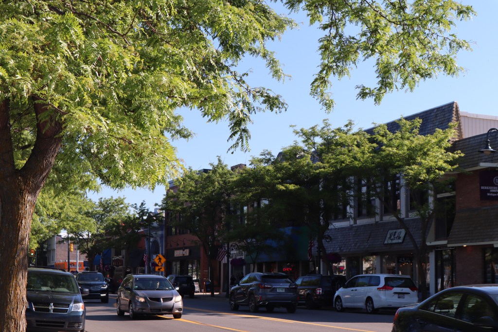
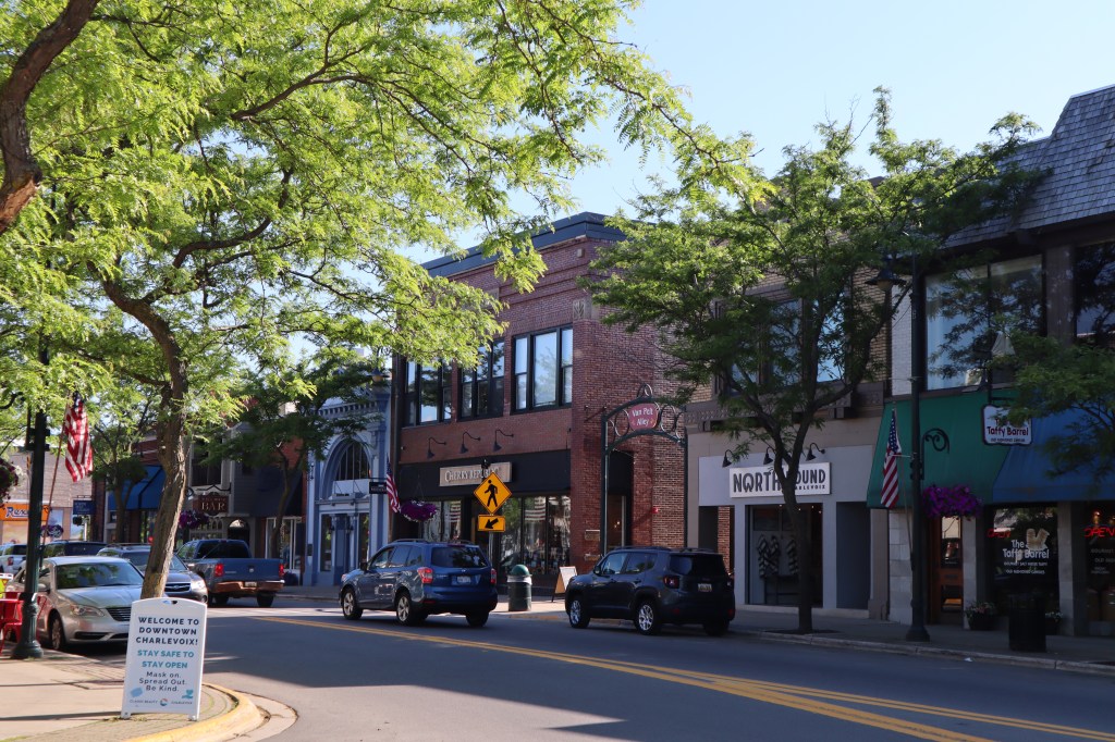
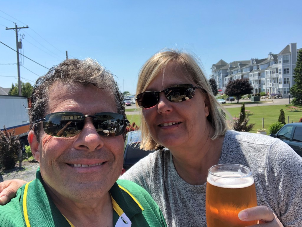
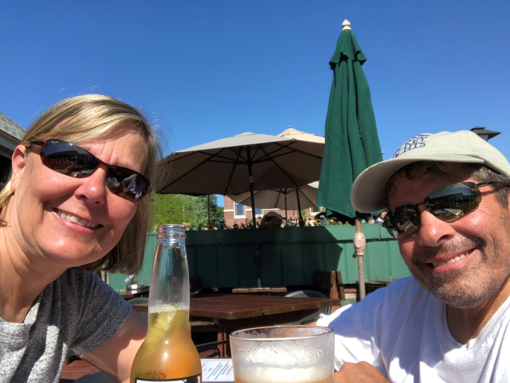
We finally settled on a beer and some appetizers at the Bridge Street Brewery that overlooks the bridge coming into Round Lake.

Here’s some views from our table:

We rounded out the evening with dinner at a local mexican place that was really good. Sailing makes one tired so off to bed! More about our time in Charlevoix tomorrow!

Let’s see now, where were we? We haven’t posted for about a week since we haven’t had any or good internet in the far reaches of northern Michigan. So, back to where we left off….
It’s Wednesday June 24th and we are up at around 9 am and we left Leland, Michigan at 10:40 am heading for Northport which is a small town in Grand Traverse Bay. The distance from Leland to Northport is about 28 nm. We had a significant amount of waves and wind leaving Leland due to the recent storms. This made our exit from the dock in Leland a bit challenging. The fairways in the marina are fairly close together so we don’t have much room to maneuver and our prop walk wants to take us in the opposite direction we want to go and Painkiller is a heavy, full keeled boat without a bow thruster that doesn’t like small spaces. We, thankfully, had help getting off the dock from the dock hands in Leland but it was still a bit of a nerve racking situation and it took awhile after we left the dock for our blood pressure to get back to normal. Now I know why sailors drink! We had some good wind today and we were able to sail most of the distance to Northport. We got to Northport around 4:30 pm.
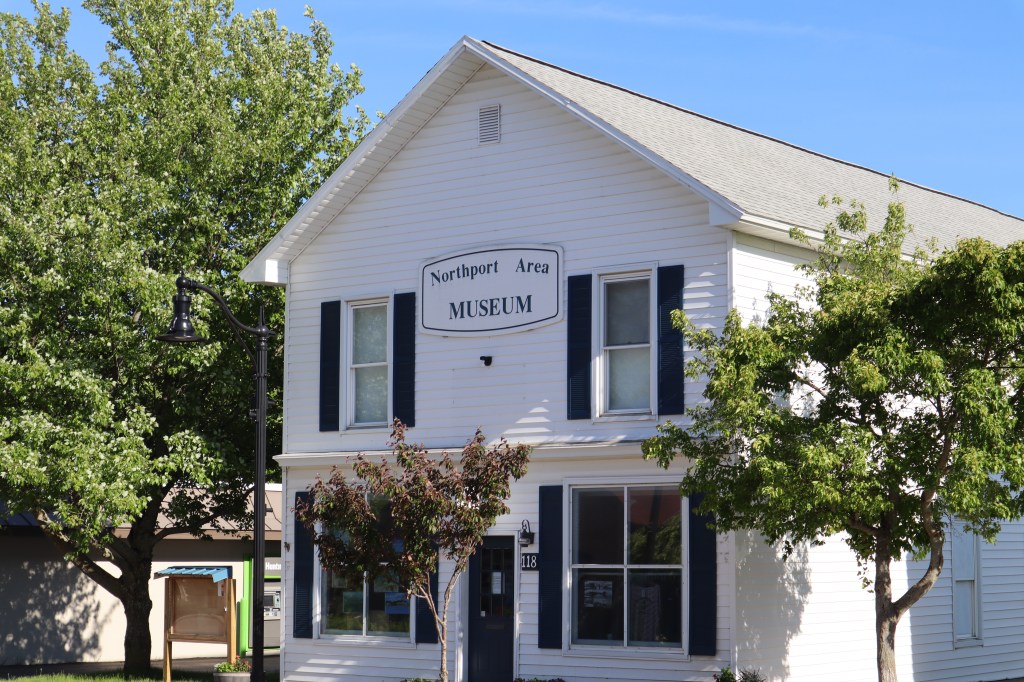
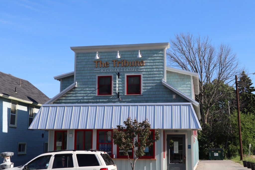
We did a bit of a walk around town and it’s a pretty small town that seemed really quiet with very few people around and a lot of the businesses not open.
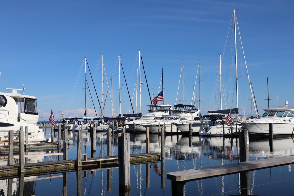
Here are some photos of the marina:


And here are some photos from our walk around town. We found this great outdoor restaurant “The Garage” that had some great food.
Although Northport was a cute small town, there just wasn’t much going on and it’s at least 6 nm out of our way to heading up the Michigan coast, so I am not sure if we would stop again. Hard to judge how much is due to COVID or not.

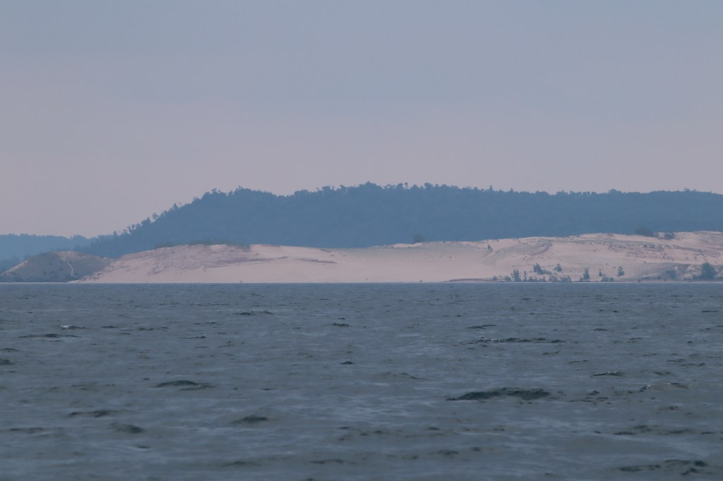
Saturday June 20th – We left Frankfort, Michigan and are headed for Leland, Michigan. We have about 36 nautical miles to go today, so we got going early this morning. There are lots of sights to see along the coast today as we will pass by Sleeping Bear Dunes National Shoreline, Point Betsie Lighthouse and South Manitou Island.
First up on our journey is Point Betsie LIghthouse. This lighthouse is said to be one of America’s most photographed lighthouses and was the last manned lighthouse on Lake Michigan before it was automated in 1983. It is still a fully operational lighthouse and fog signal that marks the entrance to the Manitou passage on the lake.


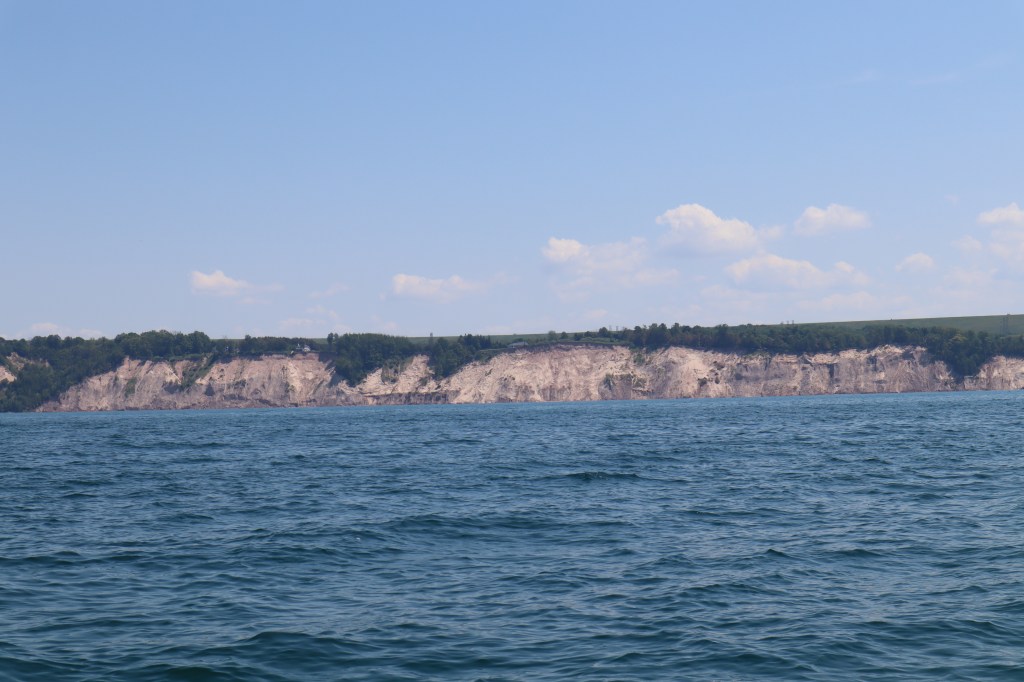
Next up was the sand dunes. I am not sure we got to see and appreciate the full beauty of the sand dunes from the water. There really isn’t anywhere to access the sand dunes via the water when you are in a large sailboat. You could likely do it in a smaller powerboat however. And hey, we have a lot of miles to cover today, so we get to appreciate what we can from the boat as we pass by.


After all the excitement, yes it is exciting when you have something on shore to look at, work with me people….we spotted a big freighter on our AIS. He is heading right toward us. This one is going to get close. At first we were on a collision course and heading right for each other, head to head. Mark altered our course to the right of the Manitou passage and the large freighter altered his course to the left of the Manitou passage. The ship is named “Beatrix” and she is 515 feet long. Our biggest freighter yet and the closest yet. We passed by her within about 1/2 nautical mile. She was steaming along at about 11 knots of speed.
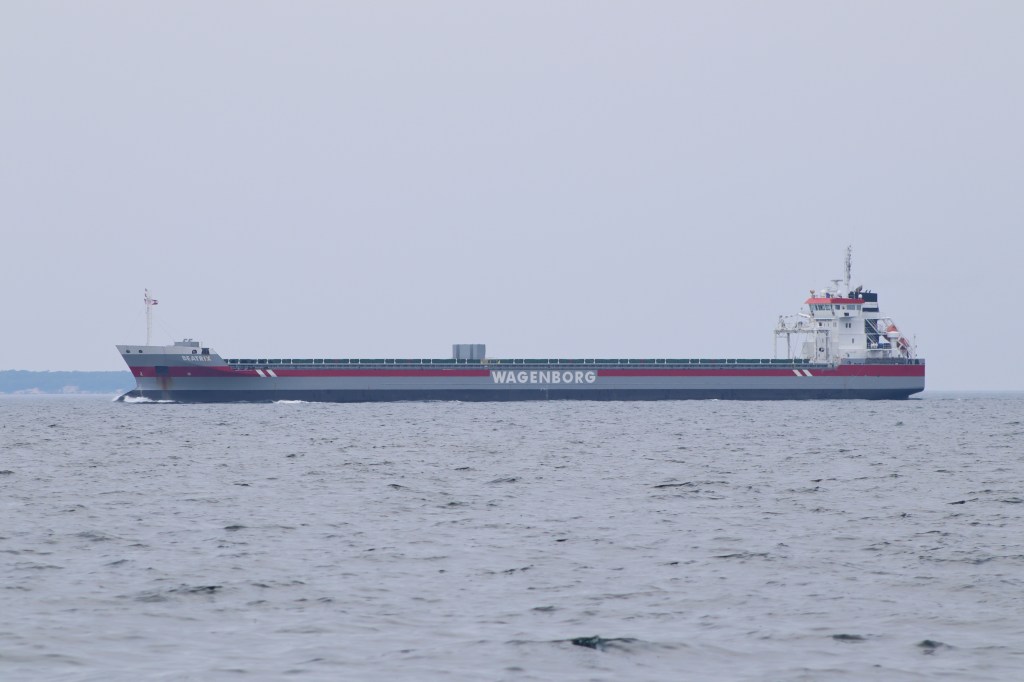
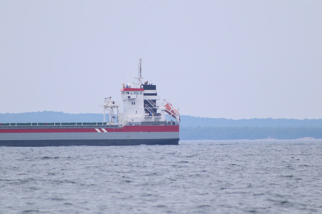
Imagine people standing up looking out those windows at the top to give you an idea of the scale of this ship.
We got into Leland just in time for happy hour and a nice steak dinner aboard the boat. We plan to be in Leland for several days since we are expecting a cold front to come through which will bring storms, rain and high winds. Also it’s nice to be in one spot for several days as we are getting a bit travel weary.

Leland is the first harbor we have been in that it feels more like people are traveling on the lake rather than just local boaters. Everyone here in the marina seems to have traveled from somewhere else, most are coming from Frankfort like us since it’s the logic next port. A sailboat pulled in next to us and it’s a couple with their 2 teenage sons. They sailed the last 36 hours straight from Holland, Michigan. If you look at a map Holland, Michigan is in the southern part of Lake Michigan and Leland is fairly far north.
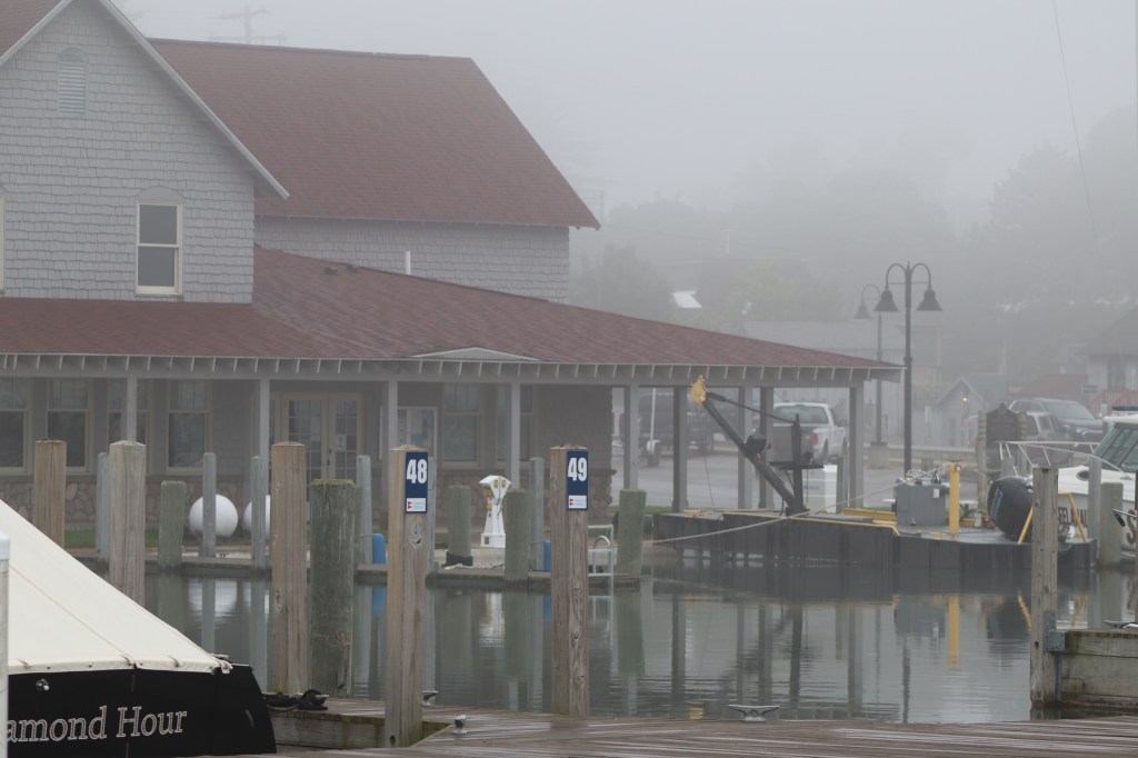
Sunday June 21st – We woke up this morning to a beautiful fog in the marina. Fog is always beautiful when you are in a marina and scary when you are out in it. Remember those big freighters?

I made some scones this morning to have with our coffee while we watched the fog since it’s Father’s day and wanted to give Mark a treat today. After our morning coffee ritual, the fog was lifting and we decided to explore the town of Leland.
Leland has it’s roots as a fishing village and it’s one of the last remaining commercial fishing villages in the state of Michigan. As a nod to Leland’s past there is a section of town along the waterfront called Fishtown. It’s on the National Register of Historic Places and the buildings were once early 1900’s fish shanties. Most of the buildings now have boutique shops and stores that have replaced the smokehouses and net storage.


One of the shops that has a bit of fascinating history behind it is the “Dam Candy Store”. The obvious origin of the name is its location right next to the dam, however kids over the years have reveled in the fact that asking to go to the “Dam Candy Store” allowed them to swear in front of their parents and not get in trouble. So, you can image how many times this was repeated.
We wandered around the cute village, the population of Leland is only 377, however there is a lot going on in this tourist town in the summer months.


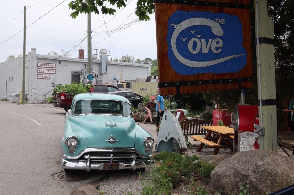
We stopped for lunch at a great restaurant called The Cove. It overlooks the dam in Fishtown.


After an afternoon of shopping and wandering, we headed back for some eventual dinner of grilled pork chops and salad aboard the boat. Relaxing, chatting with boat neighbors and the sunset rounded out our evening. This is really the first place we have been that we have been able to see the sunset over Lake Michigan. Leland harbor is only separated from Lake Michigan by a rock break wall.


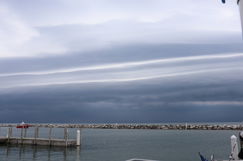
Monday June 22nd – We awoke this morning to the arrival of the cold front that we knew was heading our way. The sky looked pretty ominous as the front was ushered in and brought sustained winds of 30 knots with higher gusts and some rain. When looking at the radar, this is a large low pressure system that is heading over us and this is just the leading edge of the low. A steady stream of boats were coming in all day today to get out of the weather and tied to a dock. Today was spent doing lots of maintenance and upkeep items that we haven’t gotten around to yet. It was laundry day, run to the grocery store day, blog writing, boat cleaning, reading and otherwise generally relaxing.
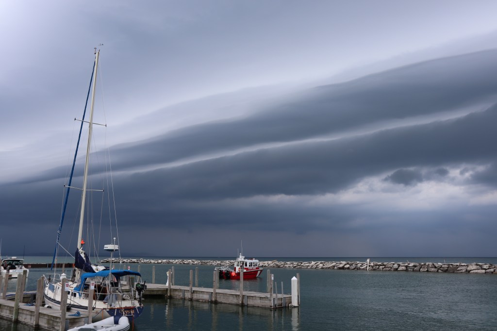

Tuesday June 23rd – Today is an all out gully gushing rain as the back side of the low pressure system is over us.

We were without internet for about half the day today, so not wanting to go out in the rain to the marina office to tell them about the Wi-fi, I tried to call them. However, we found out that their phones are not working either. So, I put on all my rain gear and walk to the marina office cuz there is nothing else to do and I can find out what is going on. I find out that the marina has 3 large electrical trunk lines that supply electricity to the marina. One of the lines is down as well as the transformer where that line comes from. This means that half the town is without electricity, no internet, no working phones in the marina and their toilets in the marina are not operating since they run on an electric water pump to flush. I guess we should be grateful that we have electricity on the boat and the docks. So, I head back in the rain to tell Mark what’s going on. No sooner do I get back to the boat and we lose electricity on the boat and docks. I guess the electric company was working on the transformer and brought stuff down to ultimately turn everything back on, as our outage was short lived.
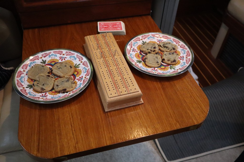
To pass the time today with the storms and no internet, we made chocolate chip cookies and played cribbage.
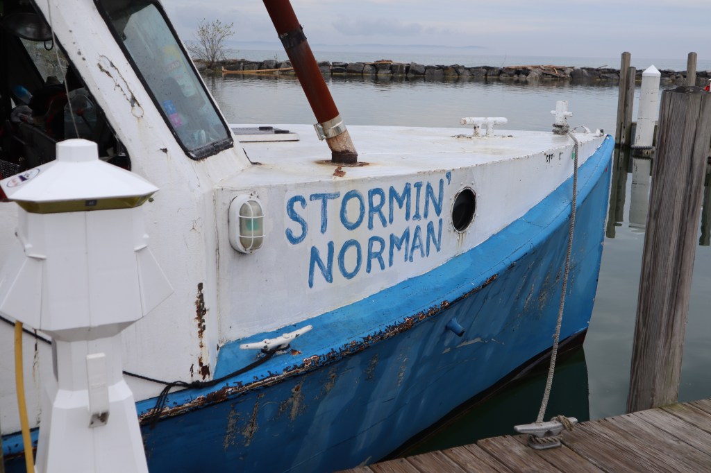
The rain lifted enough in the afternoon that people started to mill about the docks. One of the commercial fishing boat has just come in and they are loaded with a huge catch of Lake Michigan whitefish. The boat’s name is “Stormin’ Norman” which seems appropriate for the weather today.
They had at least 40 of these bins filled with fish!

I was talking with the fisherman about where they take their fish and where they are sold. There is a small fish market ashore that buys a large portion of their catch. The fish literally goes from the lake, to the boat, to 50 yards ashore to the fish market. So, we headed to the fish market to buy us some fresh catch.
Here’s the pound and a half filet of whitefish just caught hours earlier.
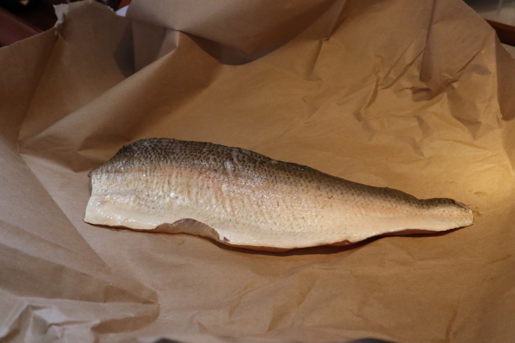
It made for a delicious dinner!


Friday June 19th – We are leaving from Manistee this morning and heading to Frankfort, Michigan which is roughly about 30 miles to go today. A bit of our morning routine – first coffee. We don’t have a coffee maker aboard that you would normally plug in at home since this would require too much electricity for us. Instead we heat water in a tea kettle on our propane stove in the galley and use a french press to make our morning coffee. This works well and uses no electricity. I was joking with a friend the other day, if we ever run out of coffee on this boat, we are pulling the EPIRB (which is our emergency rescue beacon). That is how serious we are about our coffee around here.

Now every other day so far, I would go below and bundle up in my long underwear and assorted fleece to go out sailing the lake. However today is quite warm and I am heading out without long underwear and only wearing a fleece top, shorts and bare foot. Feels so good!
Along with the heat of the day, there is little to no wind today. The lake is very flat calm, so we motored most of the way to Frankfort.


No wind, warmth and flat seas = FLIES!! This was the worse fly day yet. Not to gross anyone out but we were afraid to talk to each other in the cockpit because it seemed if you opened your mouth you might get a fly in there. They were literally littered everywhere!! It is kinda gross…. The first thing we did after docking was wash down the boat to get rid of any remnants of flies. We also showered!

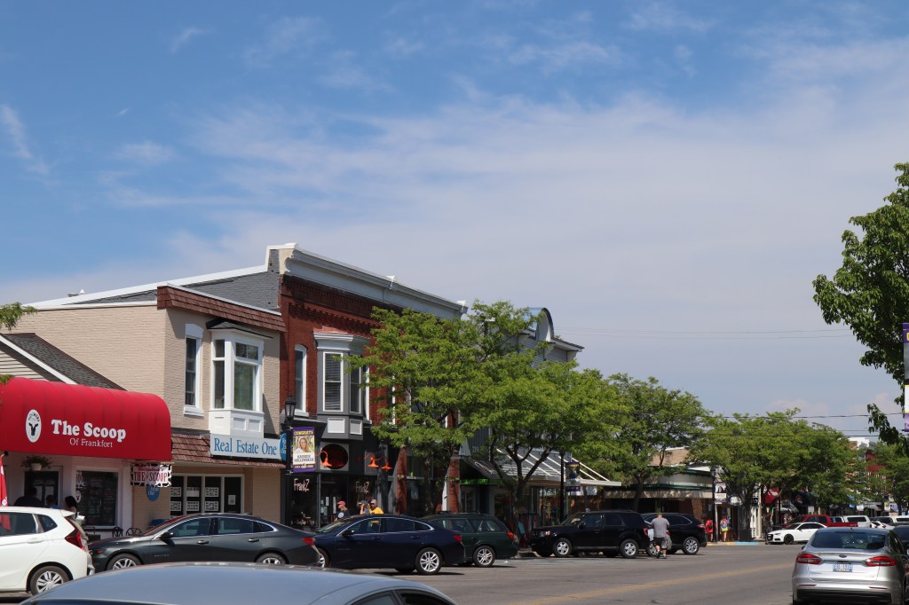
The entrance to Frankfort is the same as other harbor towns along the Michigan coast. There is a lighthouse marker at the breakwater, there is a beach and a coast guard station. I don’t know why but Frankfort seems to be the town so far along our path that is the most forgettable. The town is great and it’s pretty with great shops and a brewery, however I guess after 4 towns in 4 days, they are all starting to blend together and hard to distinguish one from the other.


The marina in Frankfort is a really nice marina. They actually have a pool as well. It is a very hot day today and the pool looked very inviting, however we opted for a shower and a walk around town. Here are some photos of the marina.


Painkiller is on the left just behind the large power boat. 2nd mast on the left of the photo.
We walked around town and hit up the local brew pub for some beers and dinner. In this neck of the woods, every restaurant has some form of white fish or perch on the menu that has likely been caught in the waters of Lake Michigan. White fish bites, white fish spread/dip, white fish sandwich, etc. All delicious I can assure you.


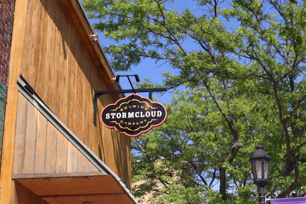


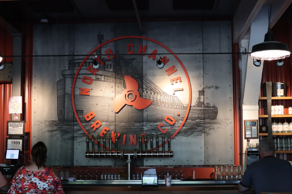
The beer at Storm Cloud brewing was just ok. Now every beer that we get is compared to what we had at Manistee at the North Channel Brewery and so far no other beer has measured up to North Channel.
COVID-19 update: Here in Michigan things are fairly conservative. We have become used to the routine of bringing our masks whenever we leave the boat to go into a town. Masks are required to enter any store or establishment. At the outdoor seating in restaurants, masks are required to interact with the hostess and from the hostess stand to your table. Once at your table you can remove your mask, but is again required to walk from your table to the exit. All servers are wearing masks and gloves. Sanitizing tables, etc. It’s funny that the smaller the town, it seems the more conservative they are about COVID and the larger the town, things are more relaxed a bit. Approaching marinas, we have seen some variations. When docking and marina staff are there waiting to help you dock, many are wearing masks to greet you. When going into the harbor master’s office to check in, often masks are required. We don’t see alot of boaters on the docks wearing masks. Most boats are at least 6 feet apart by nature and we are outside.

Thursday June 18th – Today we are traveling from Ludington, Michigan to Manistee, Michigan. If you have been following along, we crossed Lake Michigan from Manitowoc, WI to Pentwater, MI. Headed up to Ludington, MI and now heading up to Manistee, MI. Just making our way up to coast of Michigan along all the great little towns and harbors along the way. Ludington to Manistee is about 25 nautical miles, that will take us about 5 hours.
Before leaving Ludington, we checked on the SS Badger’s schedule. We see she is departing Ludington at 9 am, so we decided to hang out in the slip until after the Badger has departed. We don’t want to share a narrow outlet with the Badger. So we departed about 9:20 am. It was a pretty uneventful passage today with a mixture of sailing and motoring.
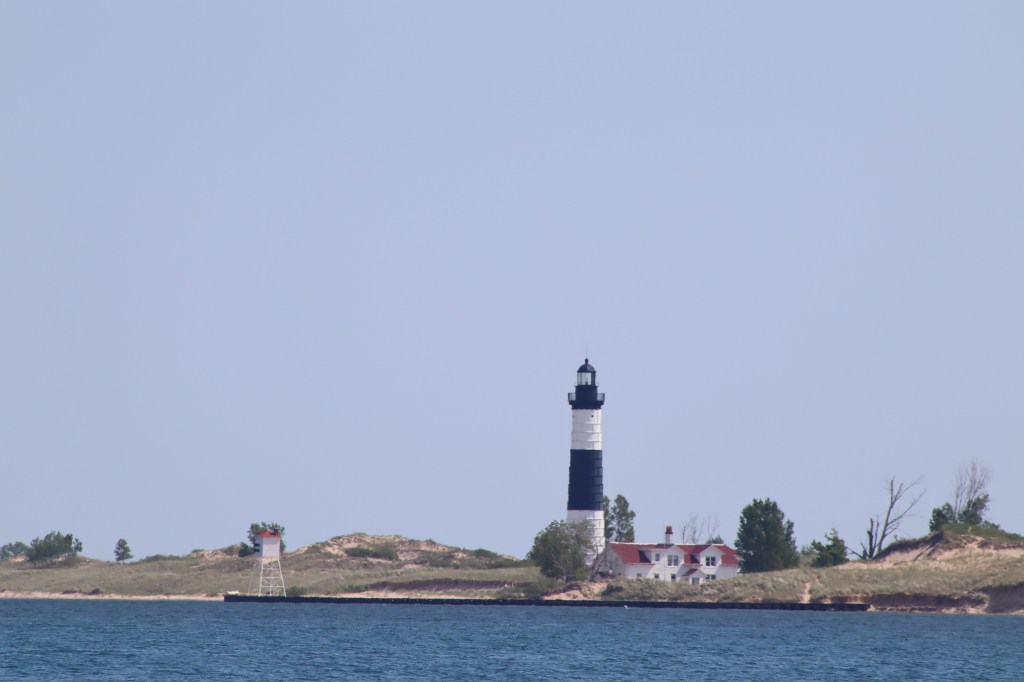
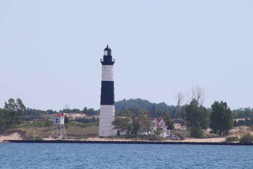
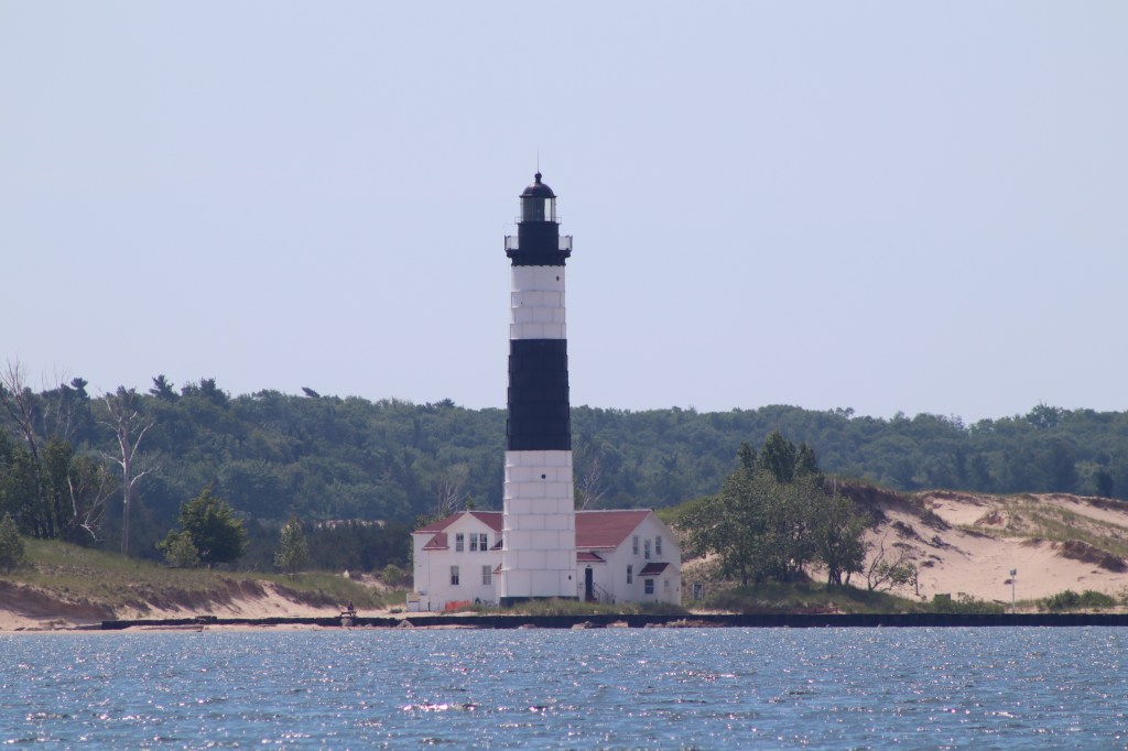
See that bump just north of Ludington that we need to go around? That’s Big Sable Point and Big Sable Point has a lighthouse, Big Sable Point Lighthouse. When on a passage, it’s the unique things on the landscape that stand out and help to break up what would otherwise be an uninteresting passing of time.
Here are some photos of Big Sable Point Lighthouse.
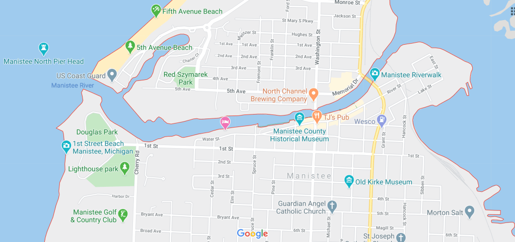
The town of Manistee sits along the Manistee river. The marina we stayed at was just to the left of the Manistee County Historical Museum on the map below. You will notice that the Manistee river leads into this lake area, however there is a bridge to enter the lake that we can’t get under and most of the lake is too shallow for us. The marina being right along the shore of the river was a different landscape than all the other ports we have been to so far. There is a river walk all along the shore that passes all the boats in the marina. The only downside of this is that our boat felt very accessible to anyone walking past, so this was one of the only times we locked up the boat when we left to explore town.
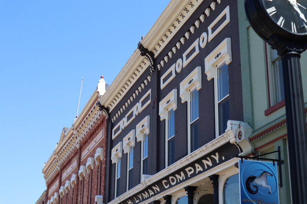
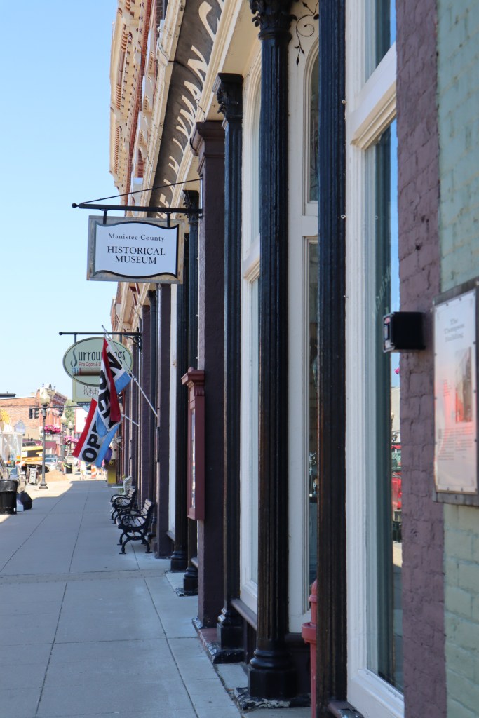
The marina was completely rebuilt by the city in 2012 so the docks are in great shape as well as the marina building with restrooms, etc. Manistee is a well preserved Victorian town with some great architecture that house small boutiques and shops.
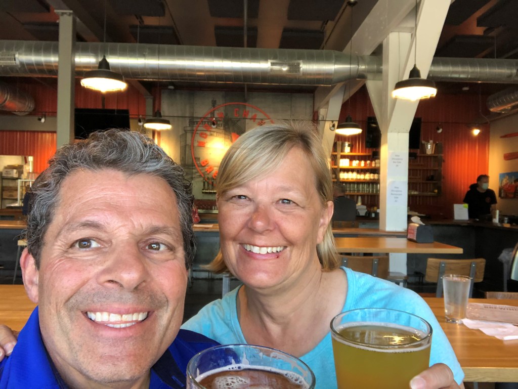
What we particularly liked in Manistee was the North Channel Brewing Company. The beer here was fantastic and that alone is worth a stop in Manistee.
Cheers! Til next time!

Wednesday June 17th – We woke up this morning in Pentwater, Michigan, it was a beautiful summer morning. The first time since this season that we have felt the warmth of summer. We made use of the shower facilities at Snug Harbor after enjoying our morning coffee in the cockpit of the boat overlooking the marina. We left Pentwater about 11:00 am and we are headed for Ludington. The trip from Pentwater to Ludington is short and only about 12 miles today. It was a very relaxed passage today. The winds were light and variable, so we leisurely sailed in the wind we had since we aren’t in a hurry today. We arrived in Ludington around 2:30 pm. Here are some photos of the shore along the way.

This man made structure is a hydroelectric plant. There is actually a lake, Bass Lake, on the top of this man made dam/levy. You can see the multiple electrical lines leading off on the right side of the photo.


Here’s the approach into Ludington. We have learned that almost every entrance to a harbor in Michigan has the same elements – lighthouse, beach, coast guard station and a walkway out to the lighthouse to view the sunset.

Look at how high the water is. The walkway/breakwater out to the lighthouse is nearly underwater.
Coast Guard station and the Ludington Maritime Museum.
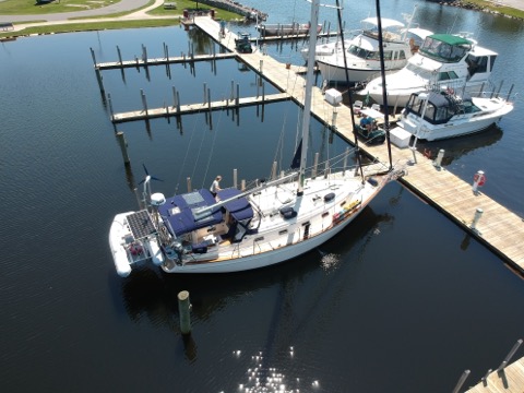
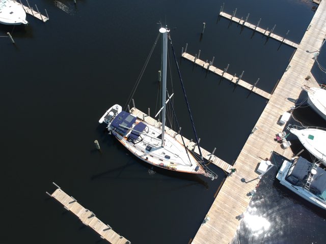
See the marina sign just below the flag pole. We just hang a left there to enter the marina. Once we got settled on the dock, we met another boater there named Tom. He was flying his drone around the marina, so we asked him, hey would you take some drone shots of our boat? He was more than willing to comply, so here are some cool drone shots of our boat. Thanks Tom!!
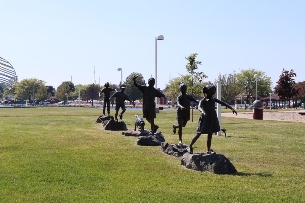
There are 2 large marinas in Ludington. One is the municipal marina, where we are docked and the other is the Harbor View Marina. Between these 2 marina is a very nice park, green space and sculpture garden. We spent a couple of hours walking around town to check things out.
Walking around makes one very thirsty, so we thought it would be a good idea to stop at the Jamesport Brewing Company to have a cold beer and some appetizers.
Later we had dinner aboard the boat and grilled some delicious chicken with salad. Right after dinner, we rushed to clean up the dishes because we knew the SS Badger was due to come into Ludington and we wanted to see her come in and get some photos. Now the Badger also comes into Manitowoc where we are usually docked, however it is not real close to the marina and you would have to walk a considerable way into town to really see the Badger come in. Not so in Ludington however, here we have front row seats to view her path into the harbor.
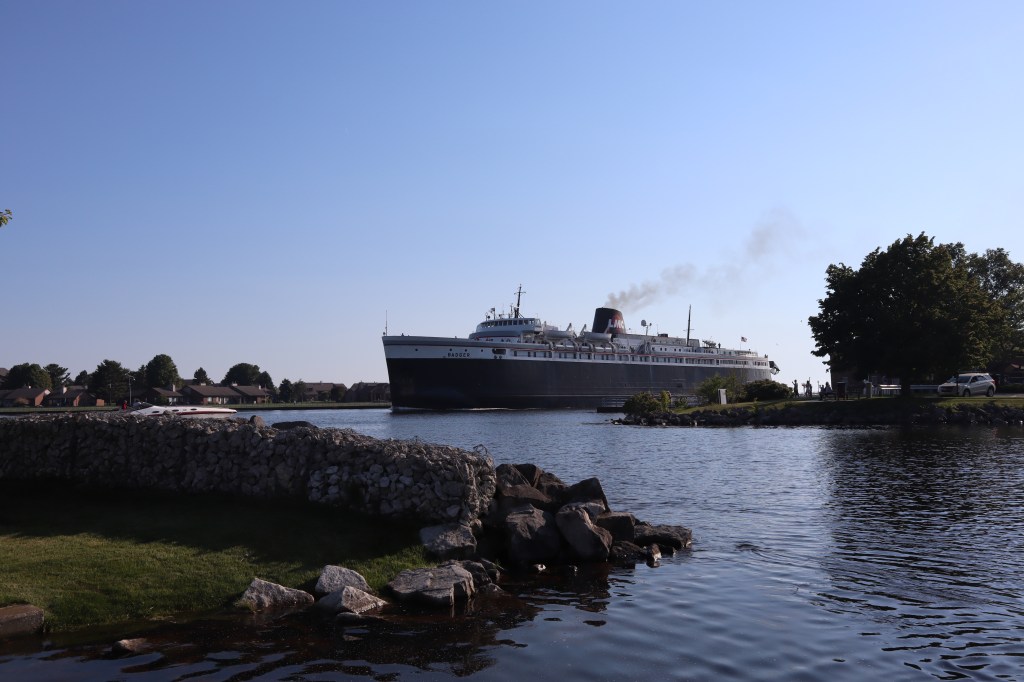


To give you an idea of the size of the Badger, those are large trucks you see in the end of the vessel.

The Badger does a full 360 degree turn in the harbor and docks just in front of the other ship you see in the left side of the photo. See the red boat to the right in this photo? It’s a police boat that accompanies the Badger to control boat traffic in the harbor when she is docking.

After all the excitement of seeing the Badger dock, we headed into town for some ice cream. After our ice cream we walked to the end of the main street out to Lake Michigan to see the beach.


Just in case you are wondering or confused, our blog is a few days behind where we actually are at any given point in time. I need time to sort through photos, download them, write a post and finally have internet to be able to post it online.
So, on Tuesday June 16th after our crossing of Lake Michigan, we arrived in Pentwater, Michigan. Our first harbor in the state of Michigan, as we work our way up the coast. We were excited to complete the crossing and now explore what this new town holds in store. Pentwater is a small town with just a handful of shops, and restaurants that line the main street. Once you enter the main channel, it opens up a bit into Pentwater Lake.

This is our view coming into the entrance to the town of Pentwater. I didn’t get all the photos I wanted on the way into Pentwater, since we were a little nervous getting the boat ready to come in and understanding where we were going. Here is a photo of the entrance on the way out.

Red and green, go between, easy enough right? We learned that the white pillar with the green mark from far off looks like another sailboat on the horizon. It isn’t until you get closer that you realize, hey that sailboat hasn’t moved in like 30 minutes.
There is a beautiful beach off to one side of the entrance right on Lake Michigan. We came in all bundled up still and there are people on the beach in swimsuits! It’s always warmer when you get into a harbor.
Pentwater has walkways all along the entrance canal that are lined with beautiful homes.

Here’s a nice shot of the Pentwater Yacht Club

We stayed at a marina call Snug Harbor. There was also a municipal marina in Pentwater however, the municipal marina is closed for the entire 2020 season while they rebuild the marina. One of the challenges on the Great Lakes currently is historic high water levels. Lake Michigan is at an all time high and is about 5 – 6 feet above normal water levels. This has created a challenge for many marinas on the Lake. For reasons we don’t quite understand many of the marinas here have fixed docks and not floating docks. With high water levels many of these fixed docks are now underwater or about to be. Snug Harbor is no exception. In the photo below where you see those posts that are in the water, normally these are out of the water and there is a dock outside of those posts that is fully underwater. If you look closely you can see electrical posts for boats to plug in along this area too. This is normally where Snug Harbor ties up larger boats. Also notice the ground by the trees, it’s all new looking dirt and gravel. They have brought in fill to raise this area about 2 feet since it was marshy and un-useable. About half of Snug Harbor marina is underwater. So, it’s a bit snug now.
For some perspective, take a look at the marina’s website photo that shows how different this area is. https://www.snugharborpentwater.com/

Here are some photos of the marina from our boat.

The marina staff where ready on the dock to greet us and help us get the boat landed and situated. They were very friendly and accommodating. After we were all tied up, we went to the office to check in and they gave us all the information we needed for our stay. The code to the bathrooms and showers, the wi-fi password, and a general overview of what is in town and what is open. After all the check in formalities, Mark and I went off to explore the town. It’s not a very big town, so it was only about a 4 – 5 block walk total from the boat down the length of the main street. There were only 2 restaurant options in town and we chose the one closest to the water. There are still many businesses closed due to COVID, which re-affirms our decision to wait a year to leave on our larger journey. You could tell that this town is bustling in the height of summer, but right down it feels very much like the off season even though summer is here. We ate outside on the patio at the Village Cafe & Pub. It’s the green building in this photo from the water. You can see the umbrellas just to the left of the flag. We had some beers, perch and onion rings, delicious!

A celebratory beer after our first crossing! Cheers until next time!

We have been watching the weather for the last several days looking for our weather window to cross Lake Michigan. We are crossing from Manitowoc, Wisconsin to Pentwater, Michigan. We have been consulting PredictWind and NOAA offshore forecasts on a daily basis. We have had a north wind for several days, which some may think is a good wind for crossing with the wind on our beam, however a north wind brings cold air and waves that build across a large portion of the lake. Monday the winds shifted out of the east, which would not be good, as we would be heading right into the wind. Starting Tuesday June 16th the winds shift out of the south with high pressure, think sunshine and warmth – relatively speaking. So, Tuesday is our day. Winds are predicted to be 10 to 15 out of the south. Should be a good passage!
The day before we leave, we spent our time readying ourselves and the boat. Filled the diesel tank, water tank, gas for the dinghy, filled propane for the galley/grill and pumped out the head. Got some last minute groceries, cleaned up the boat, stowed items so things aren’t flying around. That doesn’t sound like a lot but it took all day. We went to bed early since we are planning to get up at 4:30 am. Our plan is to leave the dock at 5 am. The passage from Manitowoc to Pentwater is about 55 nautical miles and should take us around 10 – 12 hours or so. Keep in mind that we go about 5 nautical miles per hour.
Good Morning!! We are up bright and early. The sunrise is beautiful.


Mark is getting us all unplugged from the dock so we can be off.

The marina is still and quiet this morning. The mood of the marina matches our mood. We aren’t really nervous or excited, just quietly preparing to leave the dock. Perhaps we aren’t awake yet. It seems like just another day leaving the dock and we do this all the time. I guess we have avoided thinking too much about leaving so that we don’t let our nerves take over.
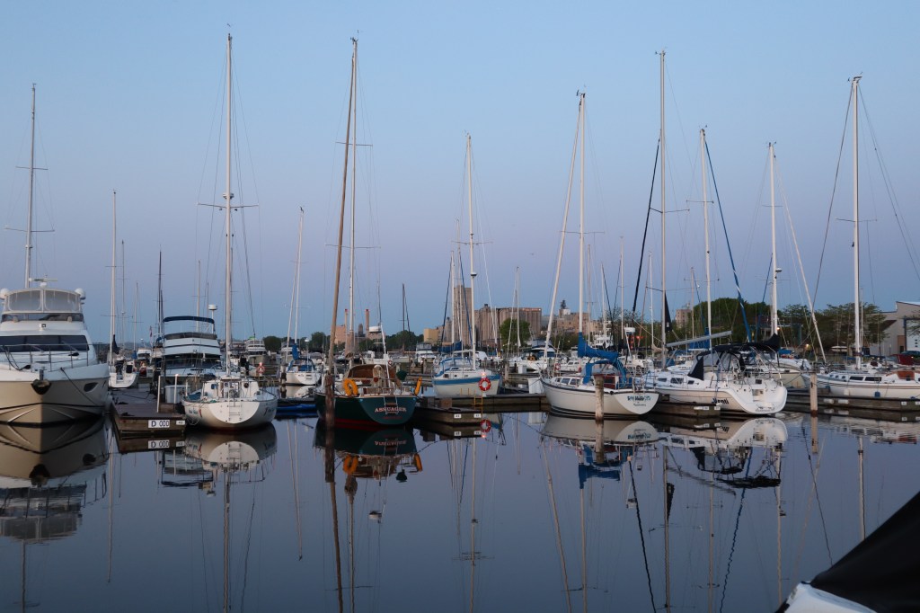
The morning is still and beautiful as we slip out of the marina while others sleep, it’s 5:10 am.


I should say that the one thing that I was worried about during the passage is the weather, not the wind mind you, but the temperatures. I don’t like to be cold. The temperature when we left was 50 degrees. I am wearing tank top, long underwear top and bottoms, fleece on top and fleece lined pants on bottom, my heavy off shore jacket, neck gaiter, hat, gloves, wool socks and my sailing boots. Mark is bundled up as well, so if he is cold, I am frozen. The forecasted high today will be 65.
6:10 am – We motored for the first hour to get a bit away from land and hoping the wind will pick up as we get further from shore. We put the sails up about an hour into our journey with the winds filling in from the southeast up to 8.2 knots. Quickly as we left the marina, the flies descended on the boat. These are small flies that really don’t fly away when they land, so now they are littered all over the boat.

Even though the sails are up and we have some wind, we are still motoring as well so that we can maintain 5 knots of speed. If we don’t maintain 5 knots, it will take forever to get to Pentwater.
About 7 miles from the shore of Wisconsin, we found the fishing fleet. There was about 8 large fishing boats out well spaced across the horizon. We know from talking to some of the fishermen at Manitowoc they are fishing for Coho Salmon. This required a little bit of our attention to decide which boats we were going to make our way through to get to the other side of the line they have created.
7:15 am – settled in enough with the sails and traffic that I went below to make coffee. Here we are settled in and enjoying coffee.

We played our sending song. What’s a sending song you ask? Well, I learned of this through another cruisers blog somewhere. A sending song is a song that you play as you are departing on a journey that signals you leaving. Now choosing this song should be carefully considered and be meaningful in some way to the vessel and/or it’s sailors. So, what’s our sending song? Cool Change by Little River Band. Look it up and give it a listen. The lyrics speak to us and we saw Little River Band at Treasure Island Casino with some great sailing friends so good memories.
8:02 am – We have turned the motor off! The winds are up to 12.8 knots and we are moving along under sail alone at 5.8 knots. We are about 10 miles off shore and still have great cell service.
8:13 am – We have spotted our first freighter on AIS. AIS is a device that transmits a ships location and details about the ship. We can see these ships on our chartplotter and we can set warning alarms to tell us when ships are a set distance from us. We set our alarms to tell us when a ship is within 3 miles from us. The freighter we “spotted” is the BBC Leda. She is 472 feet long! She is 35 miles off our port. We don’t visually see her at that distance, we will keep an eye on her to see if we get closer to her as we go.
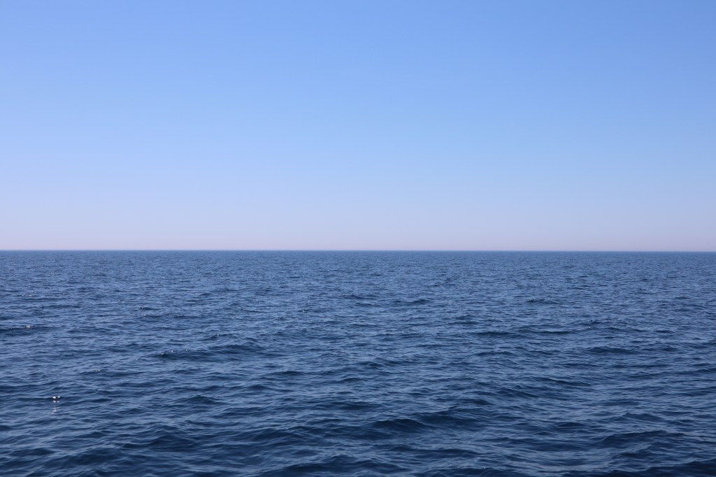
8:40 am – We are about 19 miles offshore. We can no longer see land. We are out here! Still barely have 1 bar of cell service. The water color has changed to the deep translucent aquamarine blue and it is both mesmerizing to watch and beautiful!
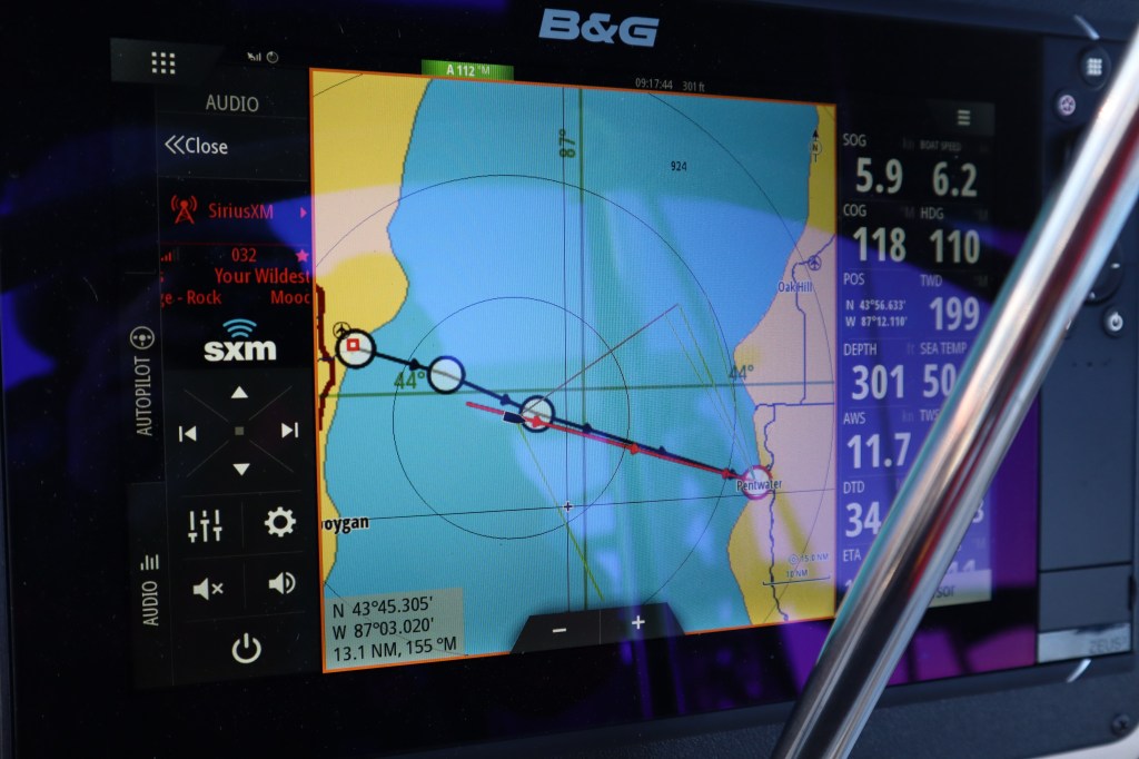
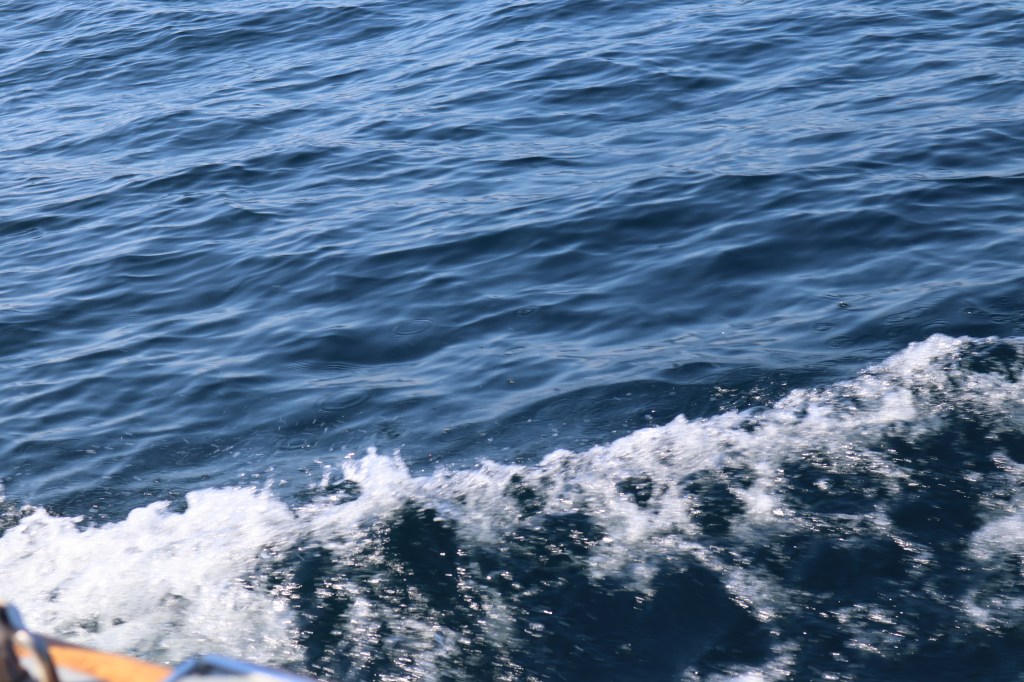
9:10 am – The wind has died back a bit to about 9 knots, so we turn the engine back on so we can maintain 5 knots of speed. We have officially lost cell coverage. The waves are more noticeable now that we are further out. Waves are about 1 – 2 feet in quick sets of 3. Not uncomfortable at all. Like if a large powerboat went by about every couple of minutes or so.
9:24 am – We are about 25 miles offshore. We are talking with Dwight, Kay and George on the VHF. Dwight and Kay left Manitowoc and are headed up to Door County. They are about 25 miles from us and we can still have a conversation loud and clear. We also spotted the Badger Car Ferry on AIS. She is about 6.9 miles from us, forward on the starboard side. We tried as hard as we could with the naked eye and the binoculars to visually spot the Badger however we did not see her. The Badger has a fascinating history, learn more about it here: SS Badger History

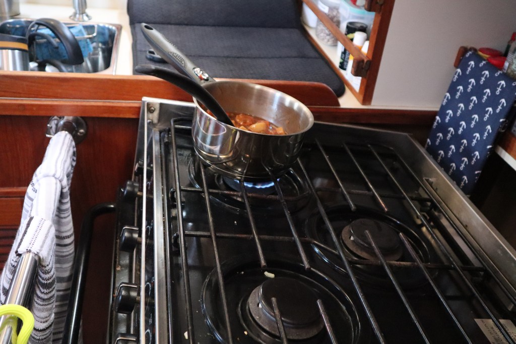
10:57 am – We are now 31 miles offshore with only 25 miles to Pentwater. More than halfway, we are literally in the middle of nowhere. The depth of the lake under our boat at the moment is 504 feet. We have turned the motor off again and sailing along at 5.6 knots. Lunch comes early when you get up at 4:30 am, so I heated up some soup to help keep us warm. A little challenging to cook on the stove when the boat is heeled over.

I don’t know if this bird smelled lunch, however we have a hitchhiker aboard. It’s an Oriole. Where did this bird come from in the middle of the lake. He doesn’t want to leave us and wanted a nice place to ride for awhile. I spent the next hour or so trying to get a photo of this bird, which proved very difficult. Sorry, no photo.
1:26 pm – Land Ho! We can see the Michigan coast line. The weather is getting warmer and the sun feels so good. Spent the next couple hours up on the fore deck sunning myself, while Mark fiddles with the electronics. I even took off my long underwear, it’s getting so nice! We are about 17 miles from our destination and we are now getting limited cell coverage.
Time now doesn’t have any point of reference, we stopped recording the time and events and we have been lulled into the rhythm of the passage, listening to music, reading books and watching the waves go by in the sun. Once we got steady cell service, we updated Facebook, caught up on the electronic world, called the marina we are headed to, etc. It seems to take forever from the time we spotted land to actually getting to said land. It’s kind of like Las Vegas, it just right over there. We arrived at Snug Harbor Marina in Pentwater at 4:20 pm. More about Pentwater in another post.
5 things that worked well on the passage:
- Upgrade to electronics – Well I guess I left out this part. Since we haven’t used our chartplotter and electronics since last fall, there were 3 software updates that needed to be completed on our electronics. Mark spent the better part of the day prior to departure trying to get our chartplotter to perform these updates. The process seemed simple enough (nothing on a boat is simple, right?). We just had to go to their website and download the update to an SD card and then insert the SD card into the chartplotter and it would update. This took hours with no success. It just wasn’t doing what we expected it to do. Finally after several hours Mark had the notion that the SD card seemed to be the issue. He was using a 64 GB SD card, should have plenty of space for the upgrade, right? Just to try something different he switch to another SD card and used a 32GB card instead. For reasons unknown to us, the chartplotter does not recognize a 64 GB card but it would recognize a 32 GB card, go figure. Nowhere in the manual or directions do they tell you this. On a positive note, we have struggled with our VHF and switching channels. If we scrolled up through the channels from 16, it would skip right past 67, 68, 69, 70, 71 and 72. The exact channels you want to talk to other boats and marinas. It appears this software upgrade has fixed the issue with the VHF!
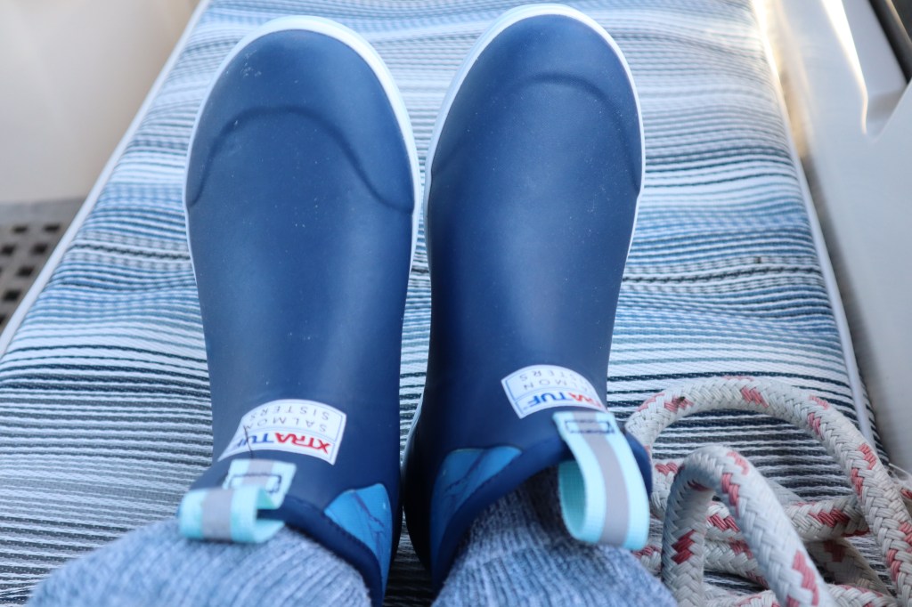
- Xtratuf Boots – I bought these before we left and left me tell you they are great! Keep my feet nice and warm! They are light enough on my feet too that I don’t feel like I clunking around deck in heavy boots.
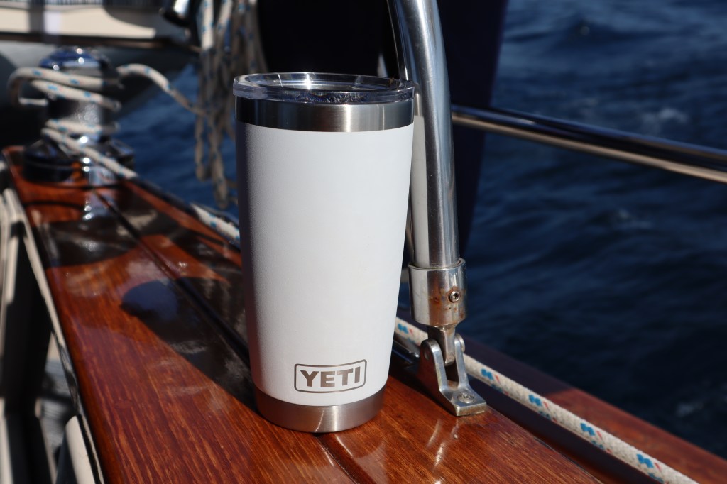
3. Yeti coffee mugs – Keeps our coffee nice and hot for hours!
4. The color of the water of Lake Michigan – simply beautiful!!
5. In the middle of the lake you can crank the music and sing at the top of your lungs and no one cares. Not that we would do that or anything!
5 things we learned on the passage
- When moving the boat we need to put the rugs in the head and the galley away. Not to worry, no accidents happened here. Just a realization as your trying to sit on the toilet with the boat heeled over…well you can just use your imagination for the rest.
- Our VHF has a range of over 20 miles!
- Our camera battery does not last the length of a passage. Need to buy another camera battery
- Birds are very difficult to photograph
- When you see land, don’t get too excited, you still have several hours of sailing before you get there.
Well, I think I should update you all on our plans for the 2020 sailing season. As you know, the original plan was to leave Manitowoc in mid-June and head through the Great Lakes, down the east coast to the Caribbean. Check out “The Plan” area of the blog. Well, clearly that was the plan since we are blogging about Plan B. Covid has thrown a wrench in many plans. We have committed to a seasonal slip in Manitowoc marina for the entire summer season for 2020. Multiple factors have played into our decision. Mostly, one of our non-negotiable items is that do not want to leave the Great Lakes without spending time in the North Channel in the most northern part of Lake Huron. This area is across the Canadian border and at present the Canadian border is closed to tourists. The North Channel is one of the top 50 places to sail in the world according to the book “50 places to sail before you die”. Even if the Canadian border were to open at some point this summer, we are uncertain what that will look like and may in fact require a 14 day quarantine period. Another factor in our decision is how we really want to experience this trip. We want to be able to go to restaurants, bars, meet people, feel comfortable having guests aboard our boat, etc. And in the current environment, it just seems that we might not have the experience we are looking for. This means the boat will spend another winter at Manitowoc marina and we will splash in the spring of 2021 and head to the Caribbean in mid-June of 2021.
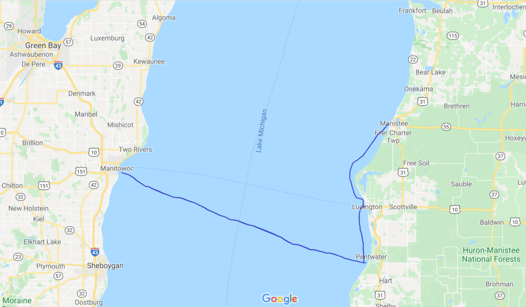
So, Plan B. What does Plan B entail? We are still leaving mid-June and crossing Lake Michigan to head over to the Michigan side and harbor hopping up the coast of Michigan to hit all the cute small towns along the way. Still making our way to Mackinac Island for July 4th, minus any fireworks celebrations since those are cancelled. Then we will head around the upper peninsula of Michigian and down the Wisconsin coast along Door county and Green Bay. Essentially we will complete a circle tour of the upper part of Lake Michigan over 3 – 4 weeks., returning back to Manitowoc marina at the end.
We will see and experience what we can. Lake Michigan has a lot to offer and we are just as excited to spend our summer here. And hey, we are retired so we have all day. Follow along as we tell you about each of the stops along the way.
