 Sailing Painkiller
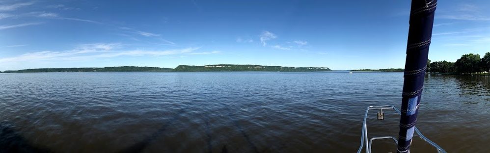

We left Georgetown and headed south to anchor just for an overnight in Graham creek just 15 miles away. Again, we didn’t go all the way to Charleston because we had a hard time getting a marina reservation and the soonest we could get into Charleston was the next day. The only thing of not on our way to Graham creek was a unique bridge that we had to go by. It is a pontoon bridge. It quite literally is a pontoon that is floated over the water between the 2 points on land to allow traffic to cross driving on the pontoon. This bridge is not used very frequently and is usually in the open position unless there is a vehicle that needs to cross. Of course when we came upon the bridge it was closed for a dump truck to head across, so we had to wait a few minutes for the truck to cross and for them to float the pontoon out of the way. Here is a photo of the pontoon in the open position.

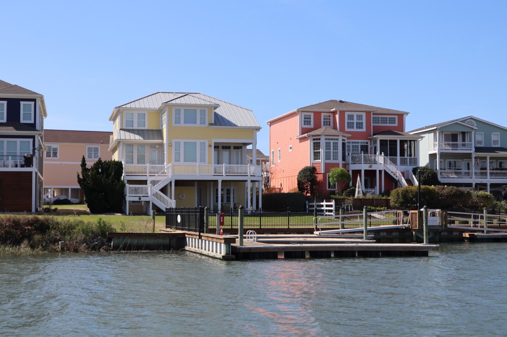
The next day we were up early and departed for Charleston at about 7:30 am. As we came into the harbor area in Charleston, there were some notable sites. First is the Cooper River Bridge. It’s the 3rd longest cable suspension bridge in the western hemisphere.

Then we sailed right by Fort Sumter. The first shots of the Civil War were fired at Fort Sumter in 1861.

And finally the historic homes and buildings that line the shore coming into the marina in Charleston.

We plan to stay in Charleston for about a week to explore the city and see all the historic sites while we are here. We pulled into Safe Harbor Charleston Mega Dock and let me tell you, there are some mega boats on the mega dock. I guess I didn’t get many photos of the mega boats because I couldn’t stand back far enough to get it in the photo. The biggest one on the dock is Gallant Lady which is 168 feet long, has a crew of 12 and can accommodate 10 guests. It was listed for sale in 2012 for $49.5 million. Here’s a pic from the interweb.

Clearly they had us park our little boat at the other end of the marina….hahahaha. Once we got settled we decided to walk around downtown from the marina. The marina has a complimentary shuttle van that will take you downtown but we wanted to get a lay of the land and explore the first day on foot.
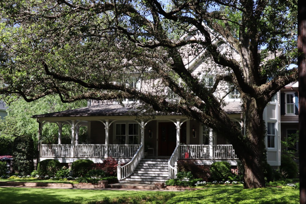
There were so many amazing and historic homes as we wound our way through the neighborhoods.


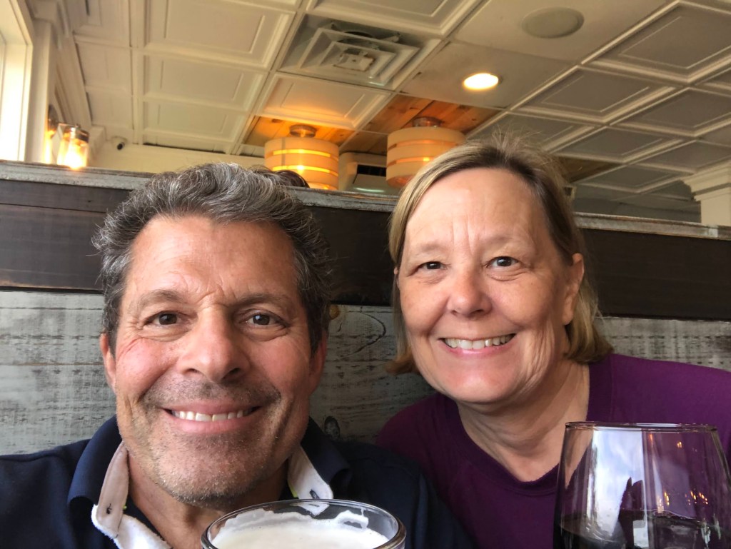
We found a great little neighborhood cafe called 60 Bull Street and stopped in to have a bite to eat. Best Shrimp Po’boy sandwich I have ever had. Mark ordered a simple grilled ham and cheese sandwich and he also said it was the best he ever had. Charleston is most definitely a foodie town. The caliber of restaurants and the level of competition here is great, so if you don’t have outstanding food, you will not make it here in Charleston. We walked all the way down to King Street which is a huge shopping district with all the big box stores you would find in any mall. Then we headed over to East Bay Street and Broad Street area to see the famous Rainbow Row. Rainbow Row is a collection of 13 colorful buildings along East Bay Street and the most photographed area in all of Charleston. At the top of the post is Mark and I in front of Rainbow Row.
After we headed back to the boat, as we were walking through the marina we met some other looper boats and stopped to chat. Of course, the chat turned into a looper happy hour on the mega dock with about 6 other boat couples.
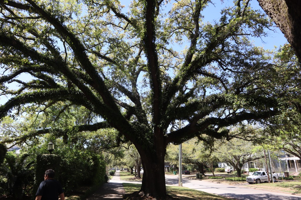
The next day we decided to take a Lyft to Mount Pleasant and tour the Boone Hall Plantation. Boone Hall Plantation is America’s oldest working plantation. Today it is still privately owned by a family that lives on the property and works it as a plantation. The plantation dates back to 1681 and was gifted to John Boone and his new wife Elizabeth by Elizabeth’s father. The property is 738 acres. The most prominent feature on the property is the avenue of live oak trees that are planted on either side of the drive as you come up to the plantation house. The oak trees were planted in 1743 by John Boone’s son. These massive live oak trees were featured in movies such as Gone with the Wind, The Notebook, and North and South. They are absolutely amazing!


We toured the plantation house, which is the 3rd house to be built in this location over the years and is not the original house. The current plantation house was built in 1936.


There are large walk through gardens on either side of the house that are very beautiful.


This is the oldest live oak tree on the property and is estimated to be over 650 years old.

We headed back after our tour and ate at the restaurant close to the marina and put our tired feet up for the night.
The next day we took the marina shuttle van into downtown to explore the Charleston City market area. This is a really cool area that has touristy booths for shopping and lots of restaurants and such. We don’t typically buy much in the way of shopping items since we are living on a boat, there is literally no where to put anything that we would buy.


Even though we took the marina shuttle down here and back we still put on 3 miles walking around today. Once we got back to the boat, we had a beer with our boat neighbors on the dock who also own an Island Packet 380, same boat as ours.
The next day was kind of a down day for us and we mostly hung out around the boat. I took a walk to a nail salon and got a pedicure since we were in a city where it was convenient to get one. The wind has been crazy for the last couple of days we have been in Charleston and we have been looking at the forecast. The next day is looking like a good weather window for us to move back north. We had planned to spend a week here but tomorrow looks to be the only good weather day so we are taking the opportunity and we feel like we got to see all the things we wanted to see in Charleston.
As we were settled in to drift off to sleep tonight, we heard some loud booms and bangs. Got up and looked out of the boat and see fireworks off the bow of our boat. How awesome! Fireworks for our last night in Charleston. I guess the fireworks were in celebration of Good Friday!

This picture is the view from our boat at the dock in Georgetown, it was just beautiful!
We left Heritage Plantation marina around 8 am to head over to Georgetown. Not too far to go today, just 10 miles or so to go today. We plan to stay 3 nights in Georgetown because we are not in a hurry and we are always watching the weather and planning where to hang out during the now predictable pattern of weather every 4 – 5 days.
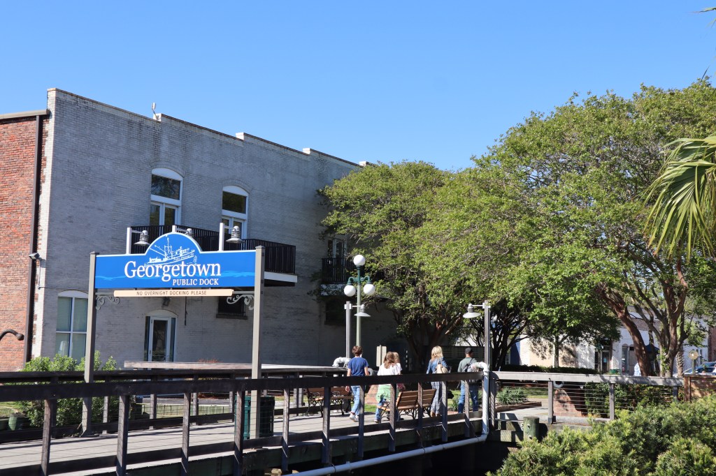
Once we made it to Georgetown and got settled we explored the town. We stayed at Hazzard marina which is just a little farther from town than the town marina in Georgetown. We appreciated the walk however and it’s only about 3/4 of a mile to town through a very pretty historic neighborhood. Georgetown is the 3rd oldest city in South Carolina with Charleston being #1 and Beaufort being #2. Georgetown also has a history rich in the production of rice. In the 1840’s Georgetown produced more than half the total rice crop in the United States. There is even a rice museum in Georgetown.
What I love about these historic towns are the live oak trees and the historic houses.
Here are some more photos from our walk around town.
We stopped and got a bite to eat at a great little sidewalk cafe in town along our walk.

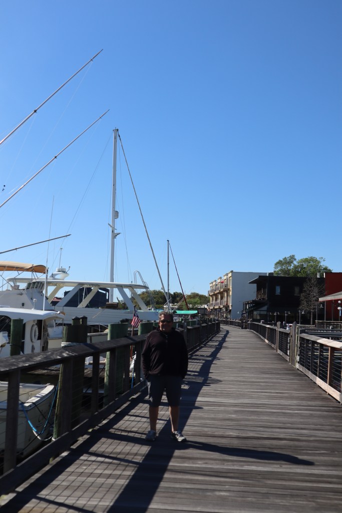
There is also a wooden boardwalk along the waterfront in Georgetown that was awesome to walk along with additional restaurants overlooking the water.
The only downside to Georgetown is there is a paper mill in town. When the wind is blow for the right direction, as it was the day we arrived, the smell from the paper mill can be downright awful! It was windy for 2 days while we were here and I was ready for the wind to stop and change directions.
The next day we were on a mission to head to the grocery store and get some fresh produce and other necessities. The nearest grocery store is a Piggly Wiggly that is 1.5 miles away. We have a great little hand cart that can either be pulled by hand or attached to a bike that we bring to the grocery store. If we need to get heavier items such as beer or water it’s nice not to have to carry that 1.5 miles back to the boat. It was a nice walk there through town and it was nice to stretch our legs. Sometimes when we are on the boat for a couple of days we need a good walk. We were able to find everything we were looking for and like most trips to the grocery store we found a few items we didn’t need as well. We loaded up our cart and made the trek back to the boat.
Now for those of you who wonder what we do all day, it does take all day to shower, get ready, walk to the store, shop, walk back from the store, bring all the stuff on the boat and put all the stuff away.
We stopped to split a burger on the way back from the store. Shopping makes one hungry.
Often on the boat we don’t always have dinner at the appropriate dinner time. Sometime our big meal of the day is what we call Linner, between lunch and dinner. We get to a dock from traveling for the day and park the boat and then we want to explore the town and exploring often includes grabbing a bite to eat at a local place and it usually happens to be 3 – 4 pm when this happens, so we have linner.
It was still really windy all night long and when we woke up the next morning it was 34 degrees! So glad we were at a dock and plugged in so we could run the heat. Brrrr….
Mark spent the day putting on a coat of varnish on the teak while I worked on a blog post and cleaning up. We wandered down to a place called Buzzard’s Roost for dinner and some live music. Nice last night in Georgetown.

Heritage Plantation marina was just an overnight stopping point. Not much of interest here and it’s right in the main channel of the ICW so no real protection at speak of. We stayed here for a couple of reasons. #1 we knew we had some weather coming in and it would likely arrive before we could make it all the way to Georgetown #2 we still had remnants of storms and rain this morning in Osprey which prevented us from leaving really early and #3 we couldn’t get a reservation at Georgetown for tonight. So here we are.
When we pulled up to the marina today the wind and current were quite high as we were coming into the dock. Both the wind and current were flowing in the same direction and at first the dockmaster wanted to put us on the inside of a dock that would have the wind and current push us into the dock. Lucky for us as we approached the dockmaster thought better of the situation and whistled to us and pointed us to the outside slip where we could head up into the wind and current as we were coming in. Much better approach! There was one other traveling boat here with us and the marina was pretty quiet. Nothing much around this marina to go and explore either, so it was a night spent on the boat grilling hamburgers and watching the storms come in in the evening. It was windy and we got some rain but nothing too bad.
On the way to the marina for the night it was just a grey and cloudy day.


The only real thing of interest today were these 2 military looking boats that passed us by today. They looked very stealth. They were painted very flat grey and didn’t show up on radar or AIS. No markings of any kind. They had some sort of jet engine and could go very fast! It literally sounded like a jet on the water and they kicked up a tremendous wake even at a slow speed.

We are excited to move on to Georgetown tomorrow and have heard great things about the town and are looking forward to exploring and visiting.

We finally made it to South Carolina. We travelled today from St James Plantation to Osprey Marina which was only about 24 miles today. However, we had a total of 18 bridges in 24 miles. 14 of them are fixed bridges that are around 65′ tall so those we don’t worry so much about but we also have 4 opening bridges to go through today as well. One of the bridges that opens is a railroad bridge that is usually always open. So I guess we really only have 3 to worry about.
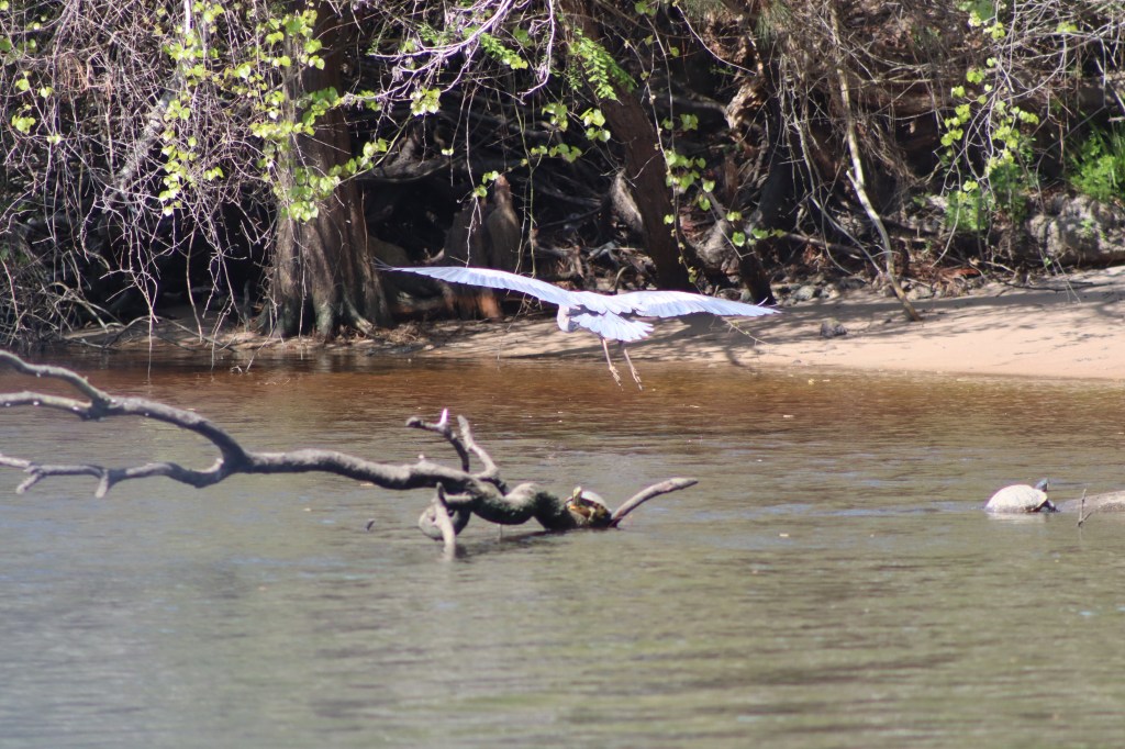
The landscape along our route today is very remote. No colorful house lining the shores. Nothing but moss covered Cypress trees along the banks and some wildlife. Here is a white crane we saw.

The turtles were out sunning themselves on the tree branches in the water all along the shore. There were a lot of turtles.


We made it to Osprey Marina about 12:30 pm and filled up with fuel and emptied our holding tank. We know we have some weather coming so we will stay at Osprey for a couple of nights while we let all the weather pass. We met some great people at Osprey, we met Steve and Pat aboard Calypso and Bob and Kim aboard Benita. We had the 6 of us aboard Painkiller for evening happy hour. Steve and Pat’s boat is parked along this long dock as you enter the marina that is very detached and far from the main area of the marina. There are golf carts parked on either end between this dock and the marina building. People hop in the golf cart to come around to the marina and then go back again and leave the golf cart on either end. Steve and Pat are the second boat in the line of boats here.


Here’s our boat looking from their boat. On the water it’s fairly close together but on land you have to go a long way around. I tell you all this because when Steve and Pat came over for happy hour about 20 mins into our happy hour it started to rain, hard and thunder and lightening. What might have been an hour or so happy hour turned into most of the evening as we enjoyed each others company until the rain let up enough for them to make the trek back to their boat with the golf cart.
The next day we just hung around the boat and took a walk around the marina area. There is really no town or anything close by within walking distance. The most interesting thing we saw was a field of goats along our walk. The evening brought a repeat of the previous evening. Steve and Pat, Bob and Kim and Steve and Pat’s friends Brian and Ellen all joined us for happy hour and of course more rain! This time they were smart enough to bring an umbrella. We all had a great time! Heading out tomorrow for points south.

We left St James Plantation to head south to Lightkeepers marina in North Myrtle Beach today. It’s about 28 miles to travel today. When we woke up to get moving it was 48 degrees this morning. We are only staying one night here before we move on again and continue to head south toward Charleston.
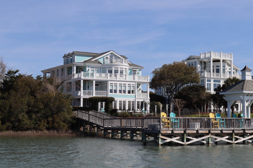
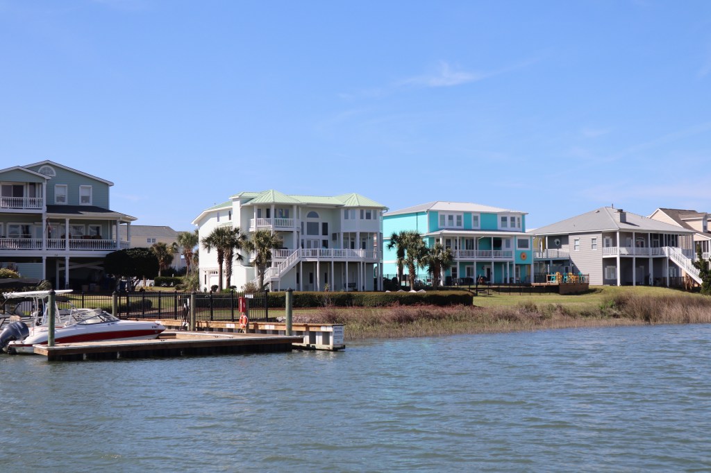
There are so many elaborate docks and colorful homes along the intercoastal waterway.
This is our first glimpse of some sandy stretch of beach that we have seen. This is by the inlet to the Little River.
When we enter a new to us marina, we generally call ahead to see if they can tell us what slip we will be in and have them describe to us which dock, will it be a port tie or a starboard tie to the dock and ensure there will be someone on the dock to catch our lines. We will also look at the marina layout on an app we have called Nebo. It provides a google earth type view of the layout of the marina and the approach so we can ask all the appropriate questions when they are describing where we should go. Here is the view of Lightkeeper’s marina from the Nebo app.

There are actually 3 marinas in this particular basin. The docks that run north/south on the left side is Lightkeeper’s Marina. The docks that run north/south on the right side is Coquina Yacht Club. And the docks that run east/west along the top is Myrtle Beach Yacht Club.
So when I was talking to the guy on the phone to determine which dock we would be going to, he tells me we will be on T dock. I always love it when the marina staff list off a letter like we have a clue where T dock is. Ok, we are looking at your marina map, where would T dock be? He starts listing off letters and tells me that starting from the entrance there is N, O, P, Q, R, S, T docks. The number of letters he is listing off doesn’t seem to equate with the number of docks I see on the map, so I try a different approach. I asked him if T dock is the last north/south running dock. He tells me no, it’s about in the middle. We later learn that yes indeed T dock is the last north/south dock in the basin, just in the middle of the basin but at the end of their portion of the marina. Then he tells me that he will put us on the end of T dock. So, I clarify, do you me at the T head, the very end of the dock? Yes, I am told. I further clarify, do I need to turn down the fairway to get to a slip or are we at the end? He assures me we are at the end. Ok, we think we have a pretty good idea of where we are going. We are coming into the marina and there are docks and boats everywhere and it’s a bit confusing and you can never see any letters or numbers on the docks. We approach the last north/south dock that we think is the T dock and there are 2 large boats on the end of the T dock and no open spot. I see a guy standing on the end of the dock waving to us. This is the right dock but there doesn’t appear to be any room at the end. I tried to hail him again on the VHF to clarify where we are supposed to go. While waiting for him to respond, I see him walk back down the dock away from the end. Where is he going? He doesn’t respond on the VHF and after a few minutes I see him re-emerge almost halfway down the dock on a finger pier and he waves to us. Mark at this point is almost past this turn in to go down this fairway. I alerted him quickly, turn here! He was able to quickly turn down the fairway. Remember the guy told us we didn’t need to turn down a fairway? It’s obvious at this point that the slip we need to be in is halfway down the fairway where he is standing and certainly not at the end of the T dock. We finally pull in and get settled, however this guy gets the prize for worse directions in a marina ever! Sometimes a bit stressful pulling into unfamiliar areas.
Once we docked, there was another sailboat that came in shortly after us and we recognized the boat, as we saw them along the ICW in our travels today. We said hello and started up a conversation with Kathy and Joe and their friend Ray. We chatted about boats for a bit and where we are from. They are local to the area and live a short distance away and this is their home marina. Later, we were getting ready to head to a nearby restaurant for dinner and this restaurant is about 1.5 miles away and we had to walk there. Kathy and Joe were getting ready to head home from the marina and offered to give us a ride and drop us off at the restaurant. Thanks! Very Nice!
We had a bit of a celebration tonight. It’s our 10th anniversary of owning Painkiller and celebrating 2 years of retirement! Loving every minute!

We only have about 18 miles to go today from Carolina Beach to St James Plantation Marina. The marinas address is technically in Southport however it is far out of the town of Southport to the south in an isolated area along the ICW. As I mentioned before we didn’t want the challenge of taking on the currents in the Cape Fear River and we are in desperate need of a washer and dryer. We haven’t done any laundry since we left New Bern and it has been about 2+ weeks. So our mission was to find a good marina with laundry.
We didn’t leave Carolina Beach until about 10 am so we could time the tide and current in the Cape Fear River so we didn’t have a 4 knot opposing current slowing us down. St James Plantation is actually a very nice gated community that has gorgeous homes and happens to have a marina within the community and they also welcome transient boaters. So there is no town here to walk to, it’s very residential and quiet. They were nice enough to put us on the end of one of their docks so it was an easy in and out for us.
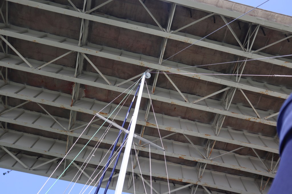
Here are some photos of the ICW along our way today. We have just 2 65′ bridges today to go through so no need to have any bridges open, we can just pass on by. It still is a bit freaky to see how close the mast is to the bridge.
We also have to go through an area known as Snow’s cut today. This is really a man made portion of the ICW that has been dug out to make a connection to the Cape Fear River. This section has been known for some significant shoaling and many have grounded in this area. Lucky for us they have just recently dredged this section of the ICW in the last few weeks so we should be good for our depth. Our boat drafts about 4’6″, for a sailboat this is not too bad. Luckily we haven’t run aground yet. (I don’t know if I should put that in writing…)
The rest of our time at St James Plantation was spent walking around, doing laundry, taking showers, etc. There was a great little gift shop/store next to the marina office. Walked in there to have a look around and ended up spending 30 – 45 minutes talking with the guy who owns the place who has sailed up in Alaska, he also has 2 beautiful dogs in the store and spent time petting the dogs. When you have all the time in the world and no agenda it’s really fun to here other peoples stories.
We did some planning as well for the path ahead of us. Our plan is to head as far south as Charleston and then turn around and head north once again to spend the summer in the Chesapeake Bay area. Come fall and cooler weather we will head south once again.

Carolina Beach is just north of Wilmington, NC on the ICW. Also just north of the Cape Fear River. We opted to stay here and then on the south side of the Cape Fear River after this to avoid having to head to a marina right on the Cape Fear River. The current on the Cape Fear River can be a bit challenging if you are trying to dock at max flood or max ebb tide. The current runs about 3 – 4 knots. At 4 knots that’s a bit less than 5 miles per hour. Water flowing that quickly can make your boat go in directions that you didn’t intend.
We left Harbor Village Marina about 10 am. We weren’t in any hurry this morning since the mornings are still quite chilly. This morning it’s 48 degrees when we left at 10 am. We only have about 20 miles to go today so not a stressful day. I know what you all are thinking…a stressful day on that water chasing our dreams, how stressful can that be? I guess you are right, we feel very lucky and fortunate to be able to do what we are doing and we are loving everyday on the water.
The ICW is peaceful and tranquil as we watch the houses, wildlife and other boaters pass by. Here are some views from this stretch of the ICW.


We have 2 bridges that we have to have opened for us on our journey today. The first is the Figure 8 Island Bridge which has a closed height of 20′ and the second is the Wrightsville Beach Bridge which has a closed height of 14′. We are about 56′ tall. Both bridges today open on a schedule. The Figure 8 Island Bridge opens on the hour and on the half hour. The Wrightsville Beach Bridge opens on the hour only. These 2 bridges are about an hours distance between the 2 so we want to get to the Figure 8 Island Bridge and go through on the hour so that we can travel an hour to the next bridge and arrive there when the Wrightsville Beach Bridges opens on the hour. If we don’t hit the first bridge on the hour we will have to likely wait 30 mins for the second bridge to open. Waiting at a bridge can be difficult with current, particularly when the current is pushing your boat toward the bridge.
Our timing today was good, we were able to get to the Figure 8 Island Bridge at the top of the hour at about 12 noon. Here’s the Figure 8 Bridge swung open as we were headed through.

We made it timely to the Wrightsville Beach Bridge for the 1 pm opening as well. Sometimes life on a boat is just very satisfying when you have good bridge timing.
We made it to Carolina Beach around 3:30 pm. Here we reserved a mooring ball for the night. Mooring balls are a great alternative to anchoring since generally you are more secure knowing you are tied up to something solid. Mooring balls are also much cheaper than a dock for the night too. A mooring ball here in Carolina Beach is $20 a night.
It was a bit windy today as we were coming into Carolina Beach but both Mark and I were very successful in picking up the mooring ball line and getting all connected. For those unfamiliar, a mooring ball is a large floating ball in the water that is tethered to the bottom generally with chain and concrete. There is a rope on the top of the mooring called the painter that has a big loop in it. The idea is that you maneuver you boat close to the mooring ball while someone on the bow of the boat uses a boat hook to reach and hook the loop of the rope that is attached to the mooring ball. Now this sounds simple enough, however throw in some wind, waves and the boat moving around as you try to grab a loop in a line with a long hook. Mark did a great job getting the boat close to the mooring ball and I was able to hook the line with my boat hook on the first try and get our dock lines around the loop of the rope. Mark and Rose for the win! And what is our prize? A glass of wine in the cockpit you say?

Carolina Beach looks like a great town to explore, however we are tired today and we are only staying one night and moving on tomorrow. It seemed like a lot of work to take the dinghy down and head into town, so we just hung out, had some wine, played some cribbage and made some dinner. We will be headed back through this area when we head north so we might have to stop at Carolina Beach again and do some exploring next time.

Today we are headed Harbor Village Marina in Hampstead, NC. After awhile all these marinas run together in our heads and it doesn’t help when all the names are similar. There are soooo many marinas have use the word Harbor. Harbor Village, Harborside, Harbor Plantation. Oh, and that’s the other term for marinas in this neck of the woods, Plantation. So many Plantations.
We are looking to stay 3 nights here in Harbor Village, there is a low pressure system/cold front coming in that will bring high winds, rain and storms. It seems like we have these cold fronts marching through every 5 – 6 days.
We woke up this morning at anchor still in Mile Hammock Bay before taking off for Harbor Village. It was quite chilly this morning in the upper 30’s and when we are at anchor and not plugged into shore power we don’t have any heat in the boat. Mark was so nice this morning to get up in the cold and start our diesel generator so we could run the heat for a bit to get the chill out of the cabin. We made coffee and that also heats up the cabin a bit with running the stove. The hot coffee warms us up as well! We only have about 20 miles to go today so no need to be in a hurry.
When I called to make reservations at Harbor Village Marina, the lady on the phone was very nice but she was very concerned that we have enough provisions aboard the boat since the marina is in a residential area surrounded by houses with no town, store or restaurant anywhere close by.
When we arrived we found a very nice, clean marina with newer docks. It is one of the best marinas we have encountered so far and the owners were super nice and helpful. Here is a look around:


As we were waiting for the owners to check us in since they were helping to dock another boat, we found a comfortable chair on the deck outside their marina office. We were just sitting looking out at all the boats in the marina. Then one particular boat caught my eye. It was the name of the boat that first got my attention. The name of the boat was “Buttery Nipple”. For those of you unfamiliar, a buttery nipple is a drink made with butterscotch schnapps and bailey’s Irish cream. We had these drinks aboard our friends, Rick and Shauna’s boat. So, seeing the boat name we snapped a picture and sent if off to Rick and Shauna to remember our evening together in Rock Hall, MD having Buttery Nipples.
As we were taking a picture of the boat, Mark looked more closely at the hail port of the boat. The hailing port on the back was St Croix Falls, WI. St Croix Falls, WI is a very small town in western Wisconsin which is about 5 miles from where I grew up and is a very unusual hailing port to find in North Carolina. Also unusual in that St Croix Falls really doesn’t have much in the way of navigable water.
Just then the owner walked up having finished helping the other boat dock. I asked her if she knew who owned the boat Buttery Nipple. She immediately said, That’s my boat! I asked her what she knew of St Croix Falls, WI. Turns out she grew up there! I told her I was from Centuria. No one knows where Centuria is or has ever heard of it. Well, she knew! She told me her family name and I was familiar with the family in the area. She asked if I knew the Quist family, as that was her husbands family. The Quist family owned the local grocery store in Centuria and of course we knew them. It is a really small world when you run into someone from a small town in Wisconsin in North Carolina.
The other couple that came in about the same time we did were also getting checked in, so we introduced ourselves and got chatting with them. We invited Steve and Anne aboard our boat later for a bit of happy hour. They are headed north and are from the Chespeake Bay area. They had been south in Florida so they had lots of great information and recommendations for us heading south. It’s always nice to hear of other people’s experiences and what is good and perhaps not good on the “road” ahead. We had a great evening.
We spent the next couple days just lounging around, playing some cribbage, cooking dinners, doing some blog posts, planning our next stops ahead and making some calls to marinas for reservations. When it wasn’t raining, we took a couple of walks around the area, there are some beautiful homes in the area.
We do really like this marina and may have to stop here again on our way back north.
Next stop Carolina Beach.

We left Swansboro a bit later this morning around 11:30 am since we didn’t have very far to go and we wanted to have a favorable tide leaving the dock. It is only about 20 miles to Mile Hammock Bay where we will anchor for the night.
Today’s challenges on our journey is one swing bridge that we need to have opened in order to go through. This is the Onslow Beach Bridge and it’s vertical clearance is 12 feet when the bridge is closed. With our mast, we are about 58 feet and would clearly not make it under a 12 foot bridge. Being a swing bridge, when it is in the open position, we have all the clearance we need to go through. This particular bridge opens on a schedule. It opens on the hour and on the half hour 24/7. So we need to time our approach so that we can make the opening either on the hour or half hour.
Generally with our aquamaps app, we will pick a point say 1000 feet before the bridge and set a route. Then we are able to adjust our speed to hit that point at either the top of the hour or the half hour. This strategy puts us still far enough from the bridge to allow them time to open and have some space to turn the boat around if necessary should the bridge unexpectedly not open for whatever reason. Hitting a bridge would be bad.
When we are within sight of the bridge we will call the bridge tender to let them know we are waiting for an opening. Even if the bridge is on a schedule, the bridge tender still wants to know your intention. So it goes something like this:
Onslow Beach Bridge, Onslow Beach Bridge, this is sailing vessel Painkiller
They will respond usually
Onslow Beach Bridge we are southbound, looking to come through at your 1 pm opening. They will generally respond ok/roger. They may give more information like other boats waiting on the other side, or tell you information about when they are opening.
Then we get out the binoculars and wait and continue our approach. Through the binoculars we are looking for traffic to stop crossing the bridge, the gate arms to go down that prevents traffic from proceeding and finally the bridge starting to open. Sometimes I swear this process seems to take forever as you are still inching closer to the bridge. This is the nerve wracking part.
Sometimes the bridge tenders are good about announcing on the VHF that they are starting the opening process that is always helpful and appreciated.
Once we see the bridge is open enough to allow us to pass, it is full steam ahead so we can pass through as quickly as possible. No one likes to sit in their car on a bridge waiting for it to close so it is nice to move along as quickly as possible. Once we are through the bridge, we call the bridge tender on the radio and thank them for the opening and to have a good day. Bridge tenders do talk to one another and you don’t want to be the one that they are talking about. Better to be polite and appreciate them for their work.
Today we are feeling proud of how we made it through this bridge and how we timed our approach. It’s the little wins when traveling by boat.
Our second challenge today is passing by Camp Lejeune. Camp Lejeune’s area includes a portion of the ICW and the land on both sides, including the beaches on the oceanside. Camp Lejeune frequently does live firing exercises that impact traffic on the ICW. If they are doing live firing exercises then they will close the ICW to all boat traffic during this time. Boats are then not allowed to go through and this could be for several hours.
I did some research online to see if I could find out if they were doing any live firing today, but information was hard to find. I did find a phone number that another boater had posted to call the base to find out but the information was about 5 years old so I wasn’t sure it was still accurate. I decided to call the number just to find out. The guy who answered the phone answered as the range commander. I guess I got directly to the right person. I just asked if they were doing any live firing today and he said no. I also asked if it was ok to anchor in Mile Hammock Bay. Mile Hammock Bay in located entirely within Camp Lejeune and owned by the marines and as such sometimes it is closed to boaters. He said it is open and fine. Great thanks!
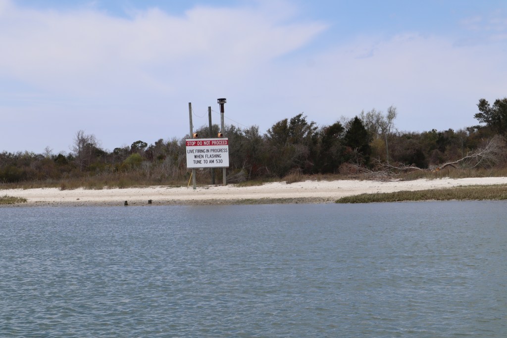
If you don’t call ahead to check on any live firing in the area, there is a sign on the ICW with flashing lights that will tell you, you can’t move beyond here.
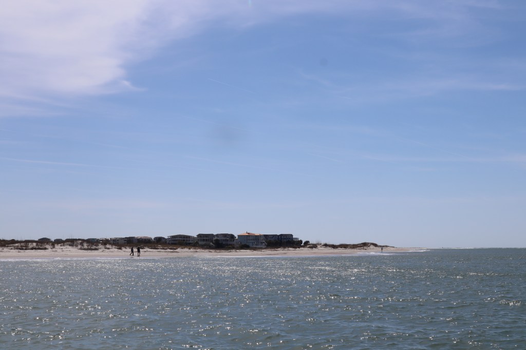
The coastline is starting to change from wooded and marshy to beaches.

We anchored in a nice little corner of Mile Hammock Bay with just 3 other boats that joined us for the evening. Plenty of room for lots more boats in here. We had some marines who were also doing some training with black inflatable ribs in the bay. There were a couple of them, no clue what they were really doing.
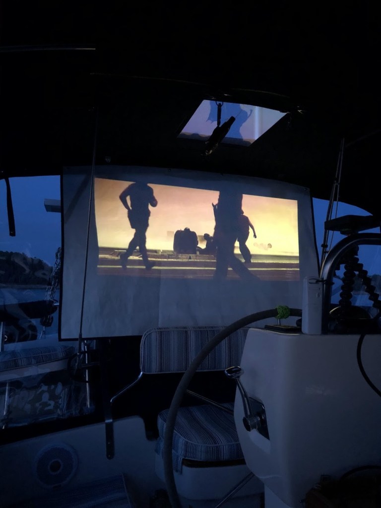
We played a couple of games of cribbage and cooked dinner and then settled in for a movie night in the cockpit. We put up the new movie screen I made and watched Top Gun until to got too cold and chased us inside for the night.

We left Beaufort around 8 am this morning. It was 39 degrees! We need to move south! The winds had died down to a reasonable level for us to make our way south to Swansboro. However, before we depart we had to take care of pumping out the head, which is very full. We made our way over to the pump out dock and since it is early in the season, apparently no one has used the pump out all winter. Where do all these people empty their heads? Mike on the dock tried to get the pump out functioning however ultimately he was unable to do so. But we really need our head pumped out. We called around to other marinas in the Beaufort area and apparently no one has a functioning pump out. We finally called ahead to Swansboro to see if we could just pump out there when we arrive. There are 4 marinas in Swansboro and there is only one pump out in the whole town and they have to call the guy to come in to do it. But they seem willing so we took off with a full holding tank to get pumped out in Swansboro.
The route along here is very rural with a few houses scattered along the ICW and the the traffic is very quiet. About halfway through our route to Swansboro we spotted our first dolphin on the ICW. Those dolphin are quick though so no pictures unfortunately.
The wind and current picked up as we came into Swansboro. Our friend Ed texted us that he rode in motorcycle to Swansboro and was waiting on the dock to greet us. How nice! We pulled into the Church Street docks to get our holding tank pumped out. Called the lady at the office and I mentioned I spoke to her earlier in the day about pumping out when we got here. Well….it was a different lady and the first lady didn’t say anything to the second lady about a boat that needs a pump out. At this point I begged. She took pity on me and called a guy to come down to pump us out.
After we got settled, we called Evelyn to have her drive down and come join us and the 4 of us shared dinner aboard Painkiller. So much fun to see them and spend time together again.
It was still pretty cold and the wind was 25 knots gusting to 30. We were supposed to stay at Casper Marina next door to Church Street docks however, we didn’t feel like moving the boat again in this strong wind and very strong current, so we stayed at Church Street for the night.
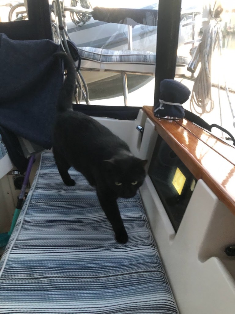
Shortly after Ed and Evelyn left us to head home, we saw a black cat that came walking down the dock. The cat was walking with purpose and came right over to our boat and climbed aboard and started walking around and checking out the place. I think she was disappointed that we were not a fishing boat. She was very friendly and well fed. As soon as she determined we didn’t have anything for her, she left as quickly as she came.
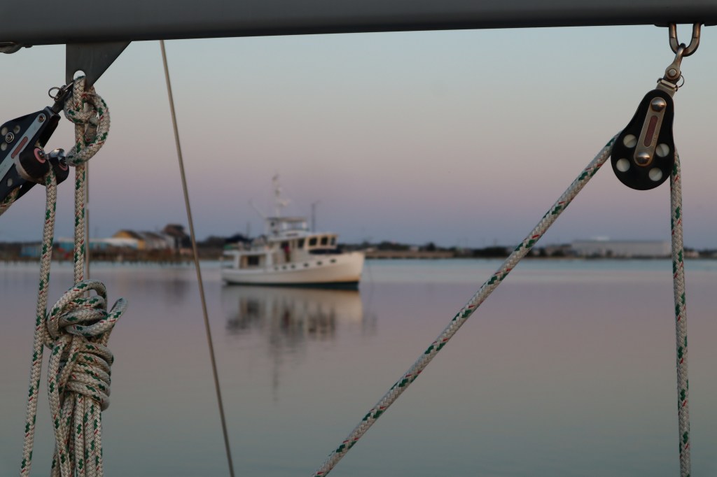
We also watched this trawler come into the area. He came in when the wind was really up still and the current was strong. He kept heading over to a low fixed bridge and we were all wondering, where the heck is he going? He turned up at the last minute and it was clear he was struggling once he turned against the current to head the other direction. For a few minutes we thought for sure he was going to get swept into the bridge. He gunned the engine and struggled to head up against the current but eventually made his way before he dropped the anchor for the night. Whew! That was stressful just watching. It’s all calm now, but here is the boat.
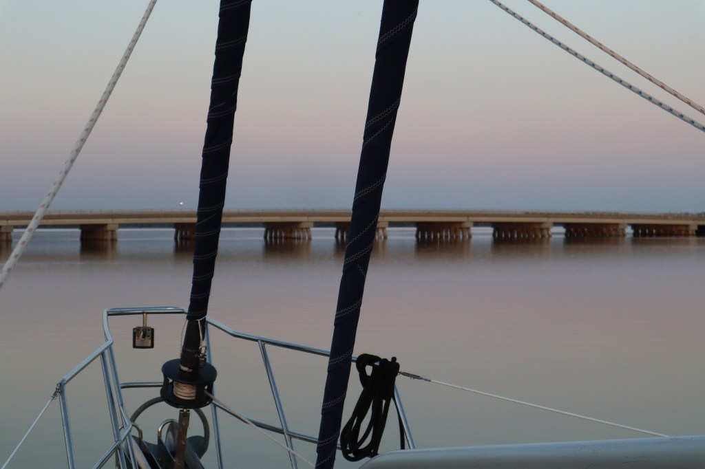
And here is the bridge
We called it a night and plan to leave in the morning. I fell asleep and was awoken around 12:30 am to the sounds of loud talking/yelling, red flashing lights and a spot light shining in our bedroom window. I got up to see what was going on. Not really sure of what is happening, all I see is a sailboat that appears to be anchored just in front of the big trawler pictured above. I also see a smaller fishing type boat that has red flashing lights and a spot light. They keep circling the sailboat. What are they up to? Thinking the sailboat was anchored, I then noticed that the boat with the red flashing lights was leaving the area but the sailboat started to follow in behind it. At first I thought the boat with the red flashing lights had snagged the sailboat’s anchor and were not towing them out with them. Then I realized, towing….oh….he’s towing the sailboat. They flashed the spot light once again at our boat and it appeared that the boat with the red flashing lights stopped towing the sailboat. He then came along side of him and started to push the sailboat right toward us! That’s when I woke Mark up. You have to see this! I thought they were going to hit our boat. However as they got closer it became apparent that the boat with the red flashing lights was towboat US and they were pushing the sailboat to the dock just ahead of us. Clearly someone on the sailboat is not having a good day and something is wrong that they can’t get to the dock themselves. They got the dock and tied up the boat. The Towboat US boat left and things quieted down for the night so we went back to bed.
In the morning we are headed to Mile Hammock Bay to anchor and I guess when we get up we will have to ask the people on the sailboat what happened.
